Catalog Archive
Auction 179, Lot 420
A Rare Map of Brazil from the Santa Teresa
"Il Regno del Brasile Parte Nobilissima del Mondo Nuovo...", Santa Teresa, J. J. de
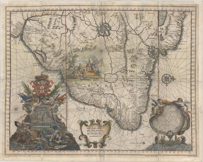
Subject: Brazil
Period: 1698 (dated)
Publication: Istoria delle Guerre del Regno del Brasile
Color: Hand Color
Size:
22.8 x 17.7 inches
57.9 x 45 cm
Download High Resolution Image
(or just click on image to launch the Zoom viewer)
(or just click on image to launch the Zoom viewer)