Catalog Archive
Auction 179, Lot 384

"A Plan of the Siege of the Havana, Drawn by an Officer on the Spot", Anon.

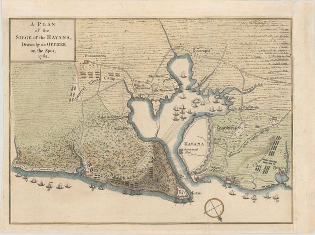
Subject: Havana, Cuba

Period: 1762 (published)

Publication: Gentleman's Magazine

Color: Hand Color

Size:
10 x 7.3 inches
25.4 x 18.5 cm
Download High Resolution Image
(or just click on image to launch the Zoom viewer)

This highly detailed battle map was published in the October 1762 edition of the Gentleman's Magazine. The plan of the harbor and region around Havana shows the location of warships and other important details during the successful attack of British forces on Havana. This 1762 siege was the final battle in the Americas at the end of the French and Indian War. Locates the fortified city of Havana, Puntal, Guadalupe, Lazaro, Corera, Guescapoa, Guanamacoa, Boconoa, and Cojimar. A large number of British warships float offshore and another 18 are in the harbor south of Havana. Also locates the camps of Col. How and General Elliot, and a large Besieging Camp is on Cavanna's Hill behind the fortified town of Morro Castle.

References: Jolly #GENT-163.

Condition: B+

Issued folding, now flattened and remargined at top and right to accommodate framing. There is minor toning and soiling and a couple of short fold separations have been archivally repaired.

Estimate: $140 - $170

Sold for: $700

Closed on 9/16/2020

Archived