Catalog Archive
Auction 179, Lot 261

"Massachusetts", Carey, Mathew

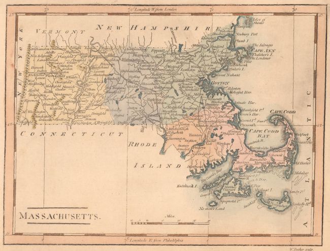
Subject: Massachusetts

Period: 1802 (circa)

Publication:

Color: Hand Color

Size:
7.7 x 5.8 inches
19.6 x 14.7 cm
Download High Resolution Image
(or just click on image to launch the Zoom viewer)

Mathew Carey was a seminal figure in early American publishing; establishing the first publishing firm to specialize in cartography and issuing the first atlas devoted exclusively to American maps. He set up an elaborate cottage system of craftsmen for compiling, engraving, printing, and coloring maps. This practice was emulated by later American cartographic publishers such as John Melish and Henry S. Tanner. The American Atlas concept was also adopted by other publishers in both the United States and Europe.

This handsome small map of the state identifies many towns and cities and locates wagon roads and rivers. It extends to show Martha's Vineyard and Nantucket. Cape Cod Bay and Plum Island are named. This is the second state with additional roads and dotted boundary lines. Originally published in Carey's American Pocket Atlas in 1796, this example comes from a later publication, either Carey's Minor American Atlas (first published in 1802) or Carey and Warner's General Atlas (first published in 1814). Engraved by William Barker.

References: Wheat & Brun #217.

Condition: A

There is some printer's ink residue in the image and light toning mostly confined to the sheet's generous margins.

Estimate: $160 - $190

Sold for: $80

Closed on 9/16/2020

Archived