Catalog Archive
Auction 179, Lot 221

"[On 2 Sheets] Topographical Map of Central California Together with Part of Nevada ",

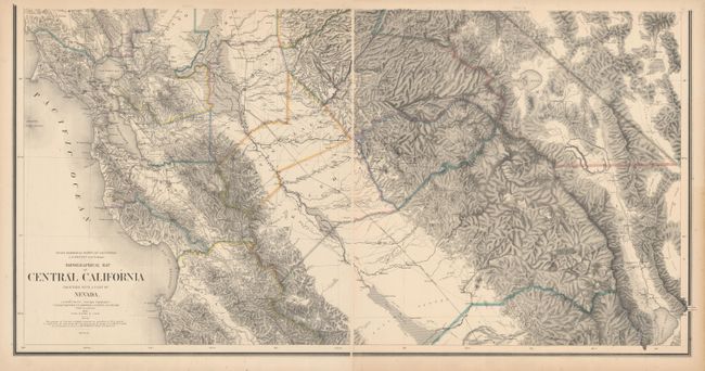
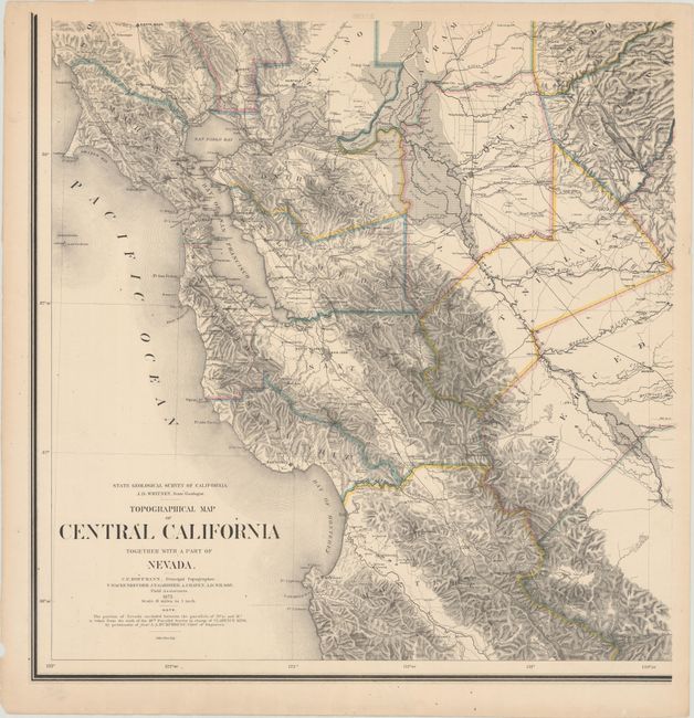
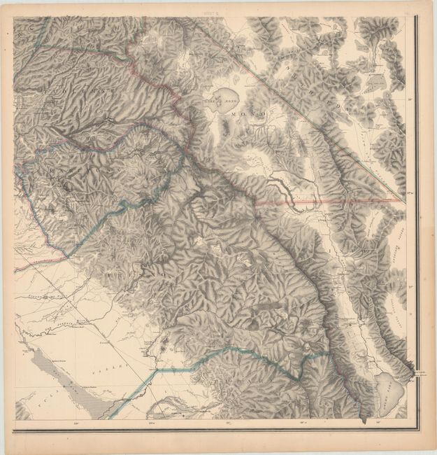
Subject: Central California

Period: 1873 (dated)

Publication:

Color: Hand Color

Size:
24.8 x 25.3 inches
63 x 64.3 cm
Download High Resolution Image
(or just click on image to launch the Zoom viewer)

This lot includes the southern two sheets of a large-scale four sheet map, though the top sheets were apparently never issued so the map is considered complete. The map extends from the San Francisco Bay area east to Mono Lake and Owens Lake and shows highly developed topography by Charles Hoffman. Locates Mt. Whitney, Mt. Williamson, Mt. Ritter and many more in the High Sierras. To the west, the map includes the street grid pattern for the larger cities in the region including San Francisco, Oakland, and San Jose. A note at bottom states that the portion of Nevada between the 39th and 41st parallels was taken from Clarence King's 40th Parallel Survey. Drawn on a scale of 6 miles per inch, and published under the direction of J.D. Whitney of the State Geological Survey of California.

References: Wheat (TMW) #1238; Rumsey #2546.

Condition: B+

Excellent impressions on heavy paper with minor foxing and a few small edge chips and tears. There is a minor puncture in an unengraved section of the western sheet (Sheet III). The first image is a composite image - the map is in two separate sheets.

Estimate: $400 - $500

Sold for: $2,300

Closed on 9/16/2020

Archived