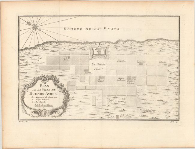
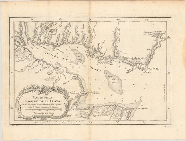
"[Lot of 2] Plan de la Ville de Buenos-Ayres [and] Carte de la Riviere de La Plata pour Servir a l'Histoire Generale des Voyages", Bellin, Jacques Nicolas
1 of 2
Subject: Buenos Aires, Argentina & Rio de la Plata
A. Plan de la Ville de Buenos-Ayres, (10.8 x 7.0"). This early plan of Buenos Aires is laid out in blocks with unnamed streets. A few important buildings are identified and the fort is prominently shown on the coast with its ramparts well delineated. Embellished with a large compass in the bay and a rococo-style title cartouche that incorporates a distance scale. Condition: A slightly weak impression at right, issued folding on watermarked paper with minor offsetting.
B. Carte de la Riviere de La Plata pour Servir a l'Histoire Generale des Voyages, (11.1 x 7.4"). This chart details the mouth of the Rio de la Plata with Buenos Aires shown on a grid plan. Baye de Monte Video is named on the north banks of the river, in present-day Uruguay. The bay is marked with soundings, anchorages, and shoals. There is a decorative rococo-style title cartouche with distance scale. Condition: Issued folding with some toning along one of the folds, faint offsetting, and light scattered foxing mostly confined to the blank margins.