Catalog Archive
Auction 177, Lot 793

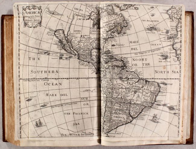
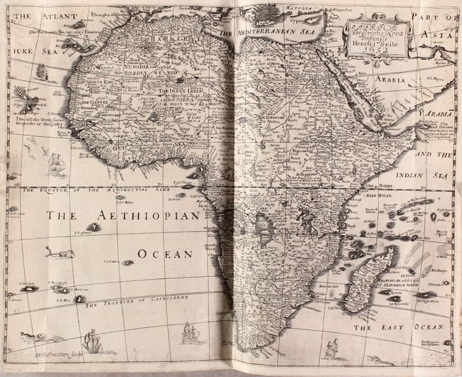
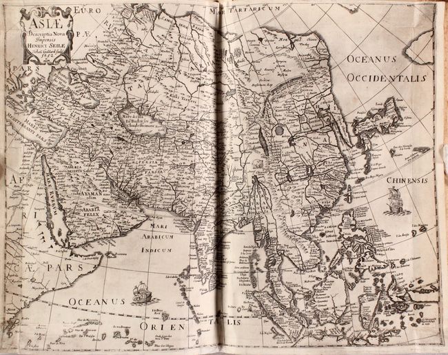
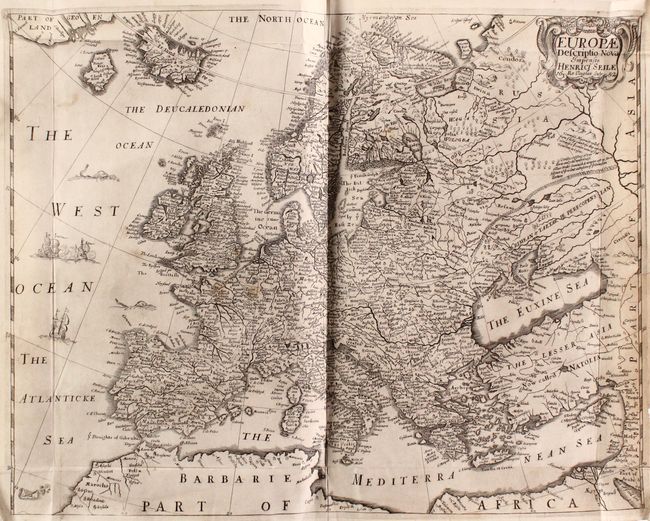
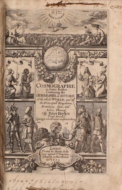
Includes Four Maps of the Continents by Henry Seile

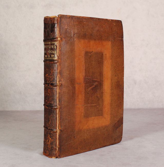
"Cosmographie in Foure Bookes Contayning the Chorographie & Historie of the Whole World, and All the Principall Kingdomes, Provinces, Seas, and Isles, Thereof", Heylin, Peter

Subject: Geography Books

Period: 1652 (published)

Publication:

Color: Black & White

Size:
9.4 x 13.8 inches
23.9 x 35.1 cm
Download High Resolution Image
(or just click on image to launch the Zoom viewer)

This comprehensive, first edition geography book is an expanded version of Peter Heylin's earlier work entitled Microcosmus. The volume is divided into four parts, with parts one and two focusing on Europe (570 pages), part three covering Asia (257 pages), and part four exploring Africa and America (287 pages). The text is augmented by four maps of the continents by Henry Seile including:

Americae Descriptio Nova Impensis (16.6 x 13.3"). This map is based on the work of Abraham Goos for John Speed's atlas. It depicts California as an Island, no Great Lakes, and a faint allusion to the northwest coast of North America. On the east coast Maryland, No: Belgium, and Long Ile are named. The name Carolina also appears off the coast. According to Burden this may be an accidental misspelling of the 'Carolana' of Sir Robert Heath's grant from 1629, or a possible reference to the French fort in present day Florida. The name Carolina was not used until 1660. The map is decorated with a title cartouche, sea monsters, and sailing ships. This is the first state. References: Burden #308; McLaughlin #13; Tooley (America) p.115, #11.

Africae Descriptio Nova Impensis (16.8 x 13.0"). This map is a close copy of John Speed's map of the continent from 1626, including many of the decorative elements. The Nile is shown with its origin in the vicinity of the Congo and conforms to the Ptolemaic concept of rivers from Lake Zaire and Lake Zaflan joining to form the mighty river. The course of the Niger River is incorrectly shown and there are many fictitious lakes in Central Africa. References: Betz #83.1; Norwich #36.

Asia Descriptio Nova Impensis (17.7 x 13.6"). The outline of the continent on this map follows the Mercator-Hondius model with a great expanse of water between a truncated Asia and North America, and a very elongated Korean peninsula. Many place names graphically depict the extent of European knowledge throughout Asia and particularly in the Philippines and East Indies. In the interior of China, the Great Wall is graphically depicted, along with an elephant and the fictitious Chiamay Lacus. The coastline of Java that is shown suggests that it is quite a bit larger than it is, and New Guinea and the Moluccas are shown as a confused group of islands. The map is adorned with two sailing ships and a decorative cartouche.

Europae Descriptio Nova Impensis (16.5 x 13.1"). This map covers all of Europe in great detail and includes Iceland and the mythical island of Frisland. This non-existent island led to considerable confusion in the mapping of Greenland and Baffin Island in the following centuries. The starkly mapped region of Russia includes some interesting notations. A sea battle, sea monsters and a decorative title cartouche make this an attractive map.

1,114 pages of English text along with decorative title page, notes to the reader, dedication, introduction, and index. Hardbound in full leather with raised bands and gilt title label on spine.

References:

Condition: B+

The maps are very good to near fine with some minor soiling and staining. All but the the America map have been backed with stiff tissue to reinforce and repair some minor edge tears and short fold separations. The text is very clean and bright with an occasional spot of foxing. Title page is lightly soiled with manuscript notations in the top and bottom blank margin. The hinges are starting, the covers have some scuffs, and the corners are bumped.

Estimate: $1,700 - $2,000

Sold for: $1,300

Closed on 4/29/2020

Archived