Catalog Archive
Auction 177, Lot 70

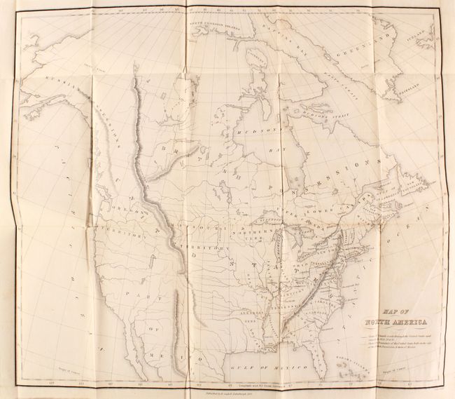
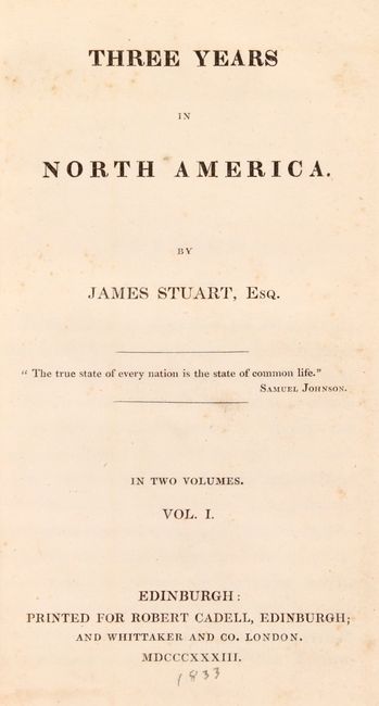
"Map of North America [bound in] [2 Volumes] Three Years in North America",

Subject: North America

Period: 1833 (published)

Publication:

Color: Black & White

Size:
5.2 x 7.8 inches
13.2 x 19.8 cm
Download High Resolution Image
(or just click on image to launch the Zoom viewer)

This is the first edition of James Stuart's account of his three years in North America. His journal presents rich descriptions of the stops along his route across the eastern half of the United States, and his writing presents a very favorable view of the United States. Four editions were printed in 1833 alone, indicating the popularity of Stuart's work. Serving as the frontispiece to the first volume is Map of North America (17.6 x 15.6"), depicting Stuart's route from New York to Savannah and along the western frontier before returning to the northeast. Cartographically, Missouri and Arkansas Territory define the western frontier with the large Missouri and Oregon territories to their northwest. Despite being published in Edinburgh, the map shows the United States claims well into present-day British Columbia, perhaps illustrating his pro-American view. Mexico is firmly in control of the Southwest, and Texas is not named. Engraved by Daniel Lizars and published by Robert Cadell in Edinburgh and Whittaker and Company in London. Rebound in maroon cloth with title on spines.

References: Howes #S-1099; Sabin #93170.

Condition: B+

The map, issued folding, has faint offsetting and a closed binding tear confined to the right blank margin. Text is very good with sporadic foxing and occasional pencil marks confined to the margins. Covers have light wear.

Estimate: $160 - $190

Sold for: $160

Closed on 4/29/2020

Archived