Catalog Archive
Auction 177, Lot 306

Rare Sea Chart of the Lesser Antilles

"Paskaert van de Caribes: Eylande. Nieuwelycks Oversien en van Veel Fouteinl Verbetert", Robijn (Robyn), Jacobus

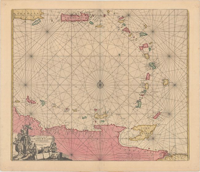
Subject: Lesser Antilles & Northern South America

Period: 1683 (circa)

Publication: Zee-Atlas

Color: Hand Color

Size:
22.3 x 19 inches
56.6 x 48.3 cm
Download High Resolution Image
(or just click on image to launch the Zoom viewer)

This is a rare sea chart of the Lesser Antilles from the southwestern shore of Hispaniola and Puerto Rico to the adjacent coastline of Venezuela. The chart is centered around a compass rose and is crisscrossed by rhumb lines. It is embellished with an interesting title cartouche at bottom left that features Native Americans and trade goods. Jacobus Robijn acquired the published rights to the Zee-Spiegel and Zee-Atlas from the estate of Pieter Goos. In the latter part of the seventeenth century, he issued a number of pilot books and sea atlases, but produced only a few maps of his own.

References: Phillips (Atlases) #493-37.

Condition: A

A fine impression with contemporary color. There is an old paper repair of a 0.75" internal tear, just to the right of the centerfold near bottom.

Estimate: $3,000 - $3,750

Sold for: $3,000

Closed on 4/29/2020

Archived