Catalog Archive
Auction 177, Lot 255

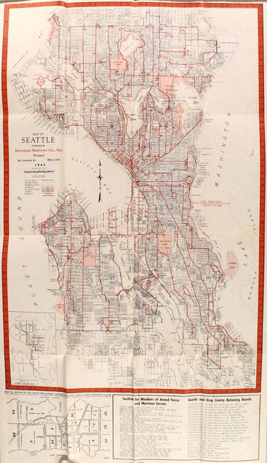
"Map of Seattle [bound in] Seattle Map and City Guide",

Subject: Seattle, Washington

Period: 1945 (dated)

Publication:

Color: Printed Color

Size:
13.3 x 20.5 inches
33.8 x 52.1 cm
Download High Resolution Image
(or just click on image to launch the Zoom viewer)

This World War II era map was published by Newman-Burrows Co., Inc and shows the street-grid pattern of the city. A legend at left further identifies schools, playgrounds, parks, and bridges, while an inset displays the "System of Street Designations." Locates Boeing Field, US Naval Air Station, and Fort Lawton with a table at bottom showing both "Facilities for members of Armed Forces" and the "Seattle and King County Rationing Boards." Folds into pictorial paper wrappers (4.0 x 6.7") along with an extensive 112 page city guide with "interesting facts about Seattle."

References:

Condition: A

The folding map is near fine with a few tiny splits at the fold junctions. Text is clean and tight, and the paper wrappers have light wear.

Estimate: $100 - $130

Sold for: $75

Closed on 4/29/2020

Archived