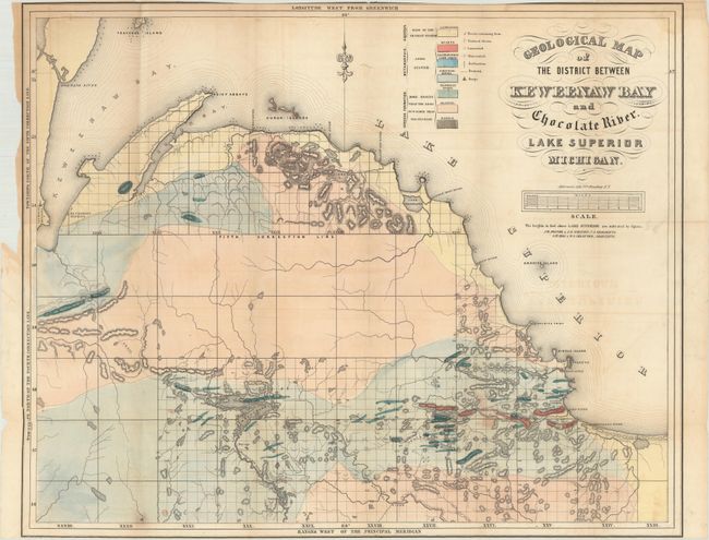
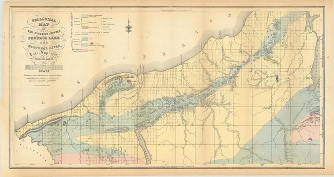
"[Lot of 2] Geological Map of the District Between Keweenaw Bay and Chocolate River. Lake Superior Michigan [and] Geological Map of the District Between Portage Lake and Montreal River, Lake Superior, Michigan", Foster/Whitney
A. Geological Map of the District Between Keweenaw Bay and Chocolate River. Lake Superior Michigan (24.1 x 19.5"). This detailed geological map covers the region from the Keweenaw Bay to the Chocolate River. A color-coded key locates seven geological types, including sandstone, quartz, limestone, schistose and trappean rocks, granite and basalt. There is also good detail of relief shown in hachure. A scale below the title converts chains to miles. Fancy title lettering. Condition: Light offsetting and trimmed to the neatline at top and bottom. (B)
B. Geological Map of the District Between Portage Lake and Montreal River, Lake Superior, Michigan (29.7 x 15.4"). Covers the area from the Michigan/Wisconsin border to Keweenaw Bay with a color-coded key locating seven geological types. Locates both a Catholic and Methodist mission along Keweenaw Bay with several trails extending into the unsurveyed interior. Condition: Light toning and minor foxing. (B+)