Catalog Archive
Auction 177, Lot 171
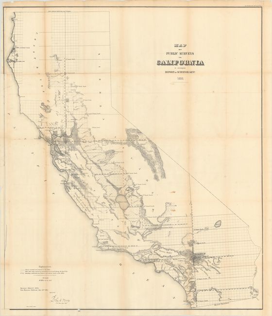
"Map of Public Surveys in California to Accompany Report of Surveyor Genl.", U.S. Government
Subject: California
Period: 1855 (dated)
Publication:
Color: Black & White
Size:
31.1 x 36.3 inches
79 x 92.2 cm
Download High Resolution Image
(or just click on image to launch the Zoom viewer)
(or just click on image to launch the Zoom viewer)