Catalog Archive
Auction 176, Lot 370

Rare Satirical Map of Europe at Start of World War I

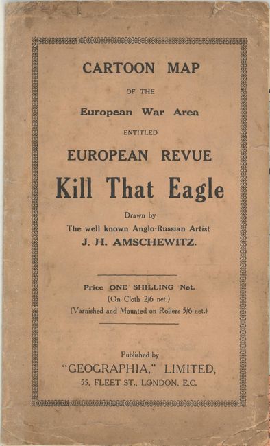
"European Revue. Kill That Eagle", Geographia Map Co

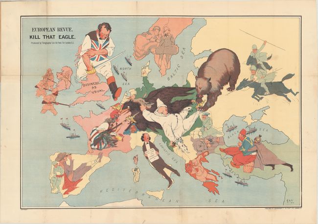
Subject: Europe, World War I

Period: 1914 (dated)

Publication:

Color: Printed Color

Size:
28.3 x 19.3 inches
71.9 x 49 cm
Download High Resolution Image
(or just click on image to launch the Zoom viewer)

This is the London edition of John Henry Amschewitz's fascinating serio-comic map, published in December 1914. Amschewitz was a British-born artist who was unable to enlist for war service due to an injury he sustained while working on a mural project in Liverpool. Instead Amschewitz focused on his interests in art and theater, themes which are apparent in this map and even the title itself: European Revue. The phrase and the portrayal of the nation as a domineering John Bull had patriotic connotations, symbolizing the strength and resilience of British business despite the war. The eagle refers of course to Germany, which has its claw on Marianne's bayonet, while its other claw is being pulled by the Russian bear. Austria is depicted as a clown with the head of an ass in one hand and Italy croons the song lyrics, "You made me love you, I didn't want to do it...," written by American Al Jolson and first published in 1913. Amschewitz's map was copied by German propagandists in 1915 with a mis-interpretation of the phrase "business as usual" to prove Britain's war-mongering ways. As Curtis and Pedersen put it in their entry on this interesting map, "It is a tribute to the power of the image that both opposing sides are able to invoke it without change, one as a rallying cry against a despised foe, the other as a warning against encirclement by their enemies." Issued in original printed paper self-wrappers.

Although the human personification of continents and countries can be seen as early as the 14th century (on maps by Opicinus de Canestris), human and animal metaphors on maps reached a new level in Europe between 1845 and 1945 with political cartoon maps. The rise of these satirical maps reflected the momentous political and cultural changes that occurred during the time. Political leaders were caricaturized and European nations were given symbolic identities that lent humor and accessibility to the geographical map. Based on popular stereotypes, these visual representations even found their way into the classroom to help bring geography and politics to life. Original serio-comic maps are very scarce due to their ephemeral nature.

References: Curtis & Pedersen (War Map) pp. 30-31.

Condition: B+

A bright example with very light soiling, issued folding and now flattened with the folds professionally reinforced with archival tissue to repair small holes at fold intersections. The map is still attached to the paper wrappers, which are moderately soiled with some extraneous creases.

Estimate: $2,000 - $2,300

Sold for: $2,000

Closed on 2/12/2020

Archived