Catalog Archive
Auction 176, Lot 103
"Route from Fort Ellis Montana to Fort Hope, British Columbia, Travelled by General Sherman July and August 1883, as Shown by Heavy Black Line", U.S. Government
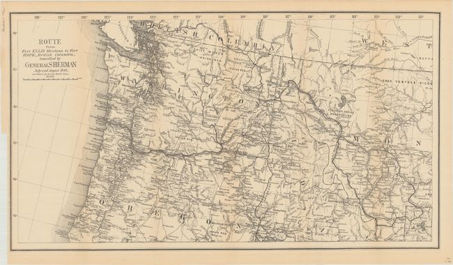
Subject: Northwestern United States, British Columbia
Period: 1883 (dated)
Publication:
Color: Black & White
Size:
27.4 x 15.2 inches
69.6 x 38.6 cm
Download High Resolution Image
(or just click on image to launch the Zoom viewer)
(or just click on image to launch the Zoom viewer)