Catalog Archive
Auction 175, Lot 175

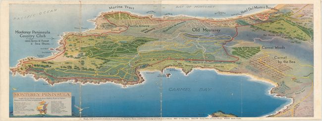
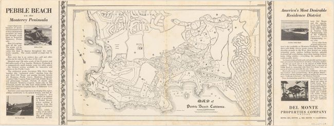
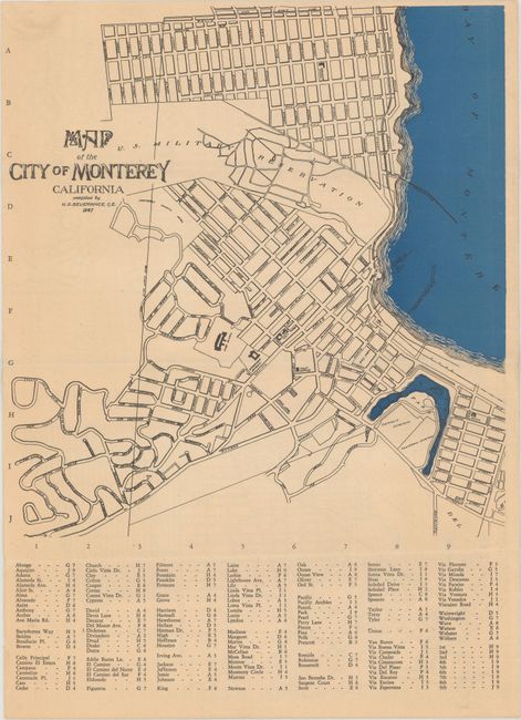
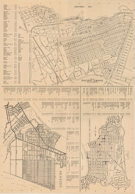
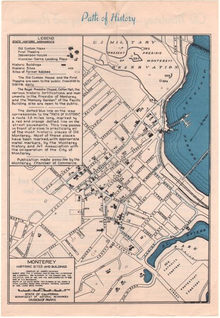
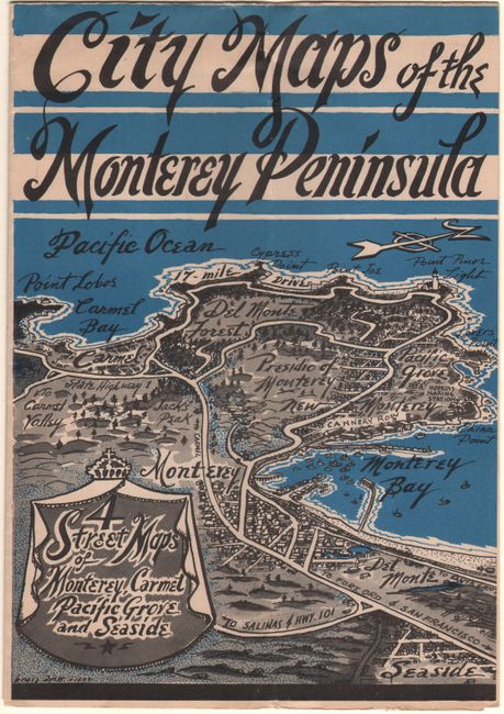
"[Lot of 2] Monterey Peninsula [and] City Maps of the Monterey Peninsula - 4 Street Maps of Monterey, Carmel Pacific Grove and Seaside",

Subject: Monterey, California

Period: 1930-47 (circa)

Publication:

Color: Printed Color

Size:
22.9 x 8.4 inches
58.2 x 21.3 cm
Download High Resolution Image
(or just click on image to launch the Zoom viewer)

A. Monterey Peninsula, by W.H. Bull, circa 1930 (22.9 x 8.4"). This bird's-eye view of the peninsula prominently depicts the Monterey Peninsula Country Club , Hotel Del Monte and Del Monte Lodge with driving routes highlighted in red and yellow. Locates the Pebble Beach Golf Course along with several others. The verso contains a detailed map of Pebble Beach by R.V. Carey dated 1928, along with text promoting Del Monte Properties. Condition: There is light soiling and abrasions along the fold lines. (B)

B. City Maps of the Monterey Peninsula - 4 Street Maps of Monterey, Carmel Pacific Grove and Seaside, dated 1947 (7.0 x 10.0"). This brochure folds out to include "Map of the City of Monterrey" (10.5 x 9.8") on the back wrapper with additional maps on recto including Pacific Grove, Carmel by the Sea, and Seaside. Laid in is a small map of "Monterey Sites and Buildings" (9.0 x 6.3"). Self-folding with a pictorial view of the peninsula by Bruce Ariss. No past sales records or institutional copies found on OCLC. Condition: A hint of toning, otherwise fine. (A)

References:

Condition:

Issued folding. See description above.

Estimate: $350 - $425

Sold for: $180

Closed on 11/13/2019

Archived