Catalog Archive
Auction 174, Lot 96

"[Lot of 3] United States of North America [and] British Possessions in America [and] Spanish Dominions in North America", Arrowsmith, Aaron, Sr.

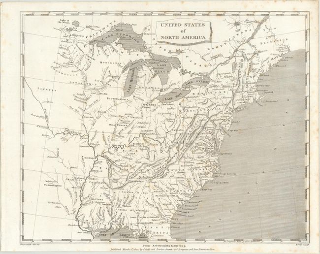
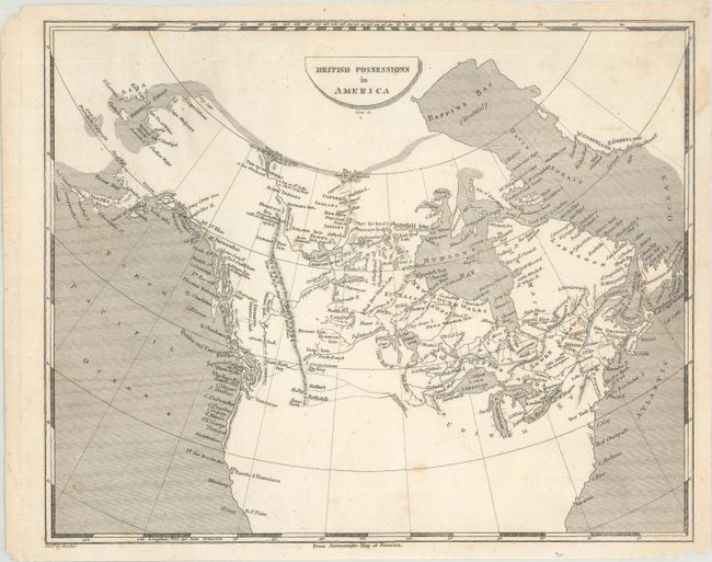
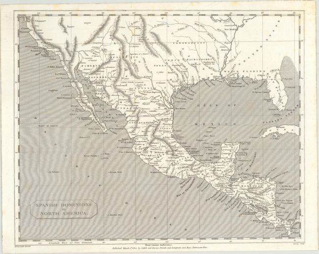
Subject: North America

Period: 1802 (circa)

Publication:

Color: Black & White

Size:
9.8 x 7.8 inches
24.9 x 19.8 cm
Download High Resolution Image
(or just click on image to launch the Zoom viewer)

A. United States of North America. A reduced version of Arrowsmith's important map of the eastern United States. Sixteen states are depicted with Georgia extending to the Mississippi River. The map provides very good detail of the Indian nations and forts on the western frontier. Published by Cadell and Davies and engraved by Lowry.

B. British Possessions in America. This map encompasses all of Canada with a possible Northwest Passage via Baffin Bay to the Bering Strait marked as "doubtful." In the far north, the map notes that the sea was seen by Hearne and MacKenzie in 1771 and 1789 respectively. Numerous Indian tribes are located, along with rivers, lakes and the Stoney Mountains. Engraved by Jones.

C. Spanish Dominions in North America. This uncommon copper engraved map by Arrowsmith shows an oddly shaped western coast of Mexico and names Texas and Cenis. It locates Santa Fe, New Orleans, St. Louis, San Antonio, Puerto S. Francisco, and much more. Florida is divided into West and East. The map further shows numerous place names, provinces, topography, missions, towns, forts, and Indian tribes. The relief is shown by hachure and the seas are fully engraved with closely placed ruled lines. A simple title cartouche floats in the lower left. Engraved by Lowry. Published by Cadell and Davies, and Longman and Rees.

Sizes vary slightly.

References:

Condition: B+

On bright sheets with faint scattered foxing.

Estimate: $200 - $250

Sold for: $170

Closed on 9/11/2019

Archived