Catalog Archive
Auction 174, Lot 93

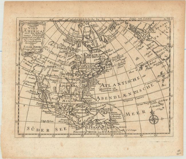
"Eine Richtige Charte von Nord America nach den Besten Neuern Charten Gezeichnet und Durch Astronomische Bemerckungen Berichtiget", Bowen, Emanuel

Subject: Colonial North America

Period: 1778 (circa)

Publication: An Account of the European Settlements in America

Color: Black & White

Size:
7.9 x 6.1 inches
20.1 x 15.5 cm
Download High Resolution Image
(or just click on image to launch the Zoom viewer)

This copper engraved map was the frontispiece of Vol. II of a German edition of Edmund Burke's An Account of the European Settlements in America. The map extends to include all of the Caribbean Islands. New France and Louisiana occupy the Midwest; western Canada is labeled in German text as "Parts Undiscovered." Santa Fe and several Indian tribes are located in the Southwest. The Northwest Passage is hinted with an unclosed "Supposed Str. Of Annian." The Colorado River is named and correctly flows into the Sea of Cortez. In Texas is Senis Tekas. Great Britain and part of Europe are seen at right. Fancy rococo-style title cartouche and compass rose embellish this compact map.

References: Sabin #9286.

Condition: B+

Issued folding with minor foxing and light toning mostly in the top blank margin.

Estimate: $110 - $140

Sold for: $80

Closed on 9/11/2019

Archived