Catalog Archive
Auction 174, Lot 78

"Hemisphere Occidental ou du Nouveau Monde Publie sous les Auspices de Monseigneur Louis Philippe Duc d'Orleans, Premier Prince du Sang", Anville, Jean Baptiste Bourguignon d'

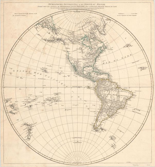
Subject: Western Hemisphere - America

Period: 1761 (dated)

Publication:

Color: Hand Color

Size:
24.1 x 25.4 inches
61.2 x 64.5 cm
Download High Resolution Image
(or just click on image to launch the Zoom viewer)

This attractive hemispheric map is by Jean Baptiste Bourguinon d'Anville, geographer to King Louis XIV and among the most respected cartographers of his day. He was an early advocate of leaving blank spaces on maps where knowledge was insufficient. The northwest coast of North America is largely blank from Nootka Sound to Cape Edgecumbe except for the note Cote vue par les Espagnols en 1775. R. courant a l'Ouest is depicted as a dotted line emerging from Lake Winnipeg, although it does not connect to the Pacific Ocean here as it does in other editions. The Russian discoveries are shown with a rough outline of Alaska. Although the map is dated 1761, it was clearly published after 1774, as evidenced by the completed coastlines of the two islands of New Zealand and the notation near Antarctica that Captain Cook had reached 71 degrees of latitude, which occurred on January 31, 1774.

References:

Condition: B+

On a watermarked sheet with light dampstains primarily concentrated in the top left quadrant. There is a short fold separation that just enters the neatline at left.

Estimate: $350 - $425

Unsold

Closed on 9/11/2019

Archived