Catalog Archive
Auction 174, Lot 745

"Carte des Costes de l'Afrique ou est Compris une Partie de Guinee, le Royaume de Benin, l'Isle de St. Thomas &c. Leve par Ordre Expres des Roys de Portugal, sous qui on en a Fait la Decouverte", Mortier, Pierre

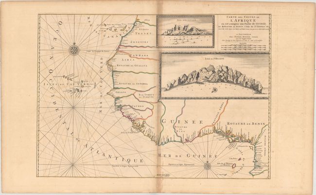
Subject: Northwestern Africa

Period: 1700 (circa)

Publication:

Color: Hand Color

Size:
30.3 x 21.2 inches
77 x 53.8 cm
Download High Resolution Image
(or just click on image to launch the Zoom viewer)

This striking chart depicts the coast of West Africa from the Canary Islands south to the C. de Lopo Gonsalves (the Cape Lopez peninsula). The inland areas are left blank, but there are plenty of place names along the coast. There are two inset views at top right, both with depth soundings in the water: Isle d'Ascension and Isle de St. Helene. The ocean is crisscrossed with rhumb lines, and there are two compass roses capped with fleur-de-lis. There are three distance scales enclosed in the title cartouche. It likely appeared in Atlas Suite de Neptune Francais.

References:

Condition: B

A fine impression with wide margins and original outline color. There is offsetting and moderate toning along the centerfold.

Estimate: $550 - $700

Sold for: $400

Closed on 9/11/2019

Archived