Catalog Archive
Auction 174, Lot 572

NO RESERVE

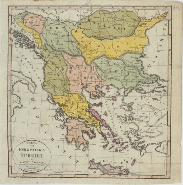
"Karta over Europaiska Turkiet", Djurberg, Daniel

Subject: Balkans

Period: 1811 (dated)

Publication:

Color: Hand Color

Size:
9.6 x 10.3 inches
24.4 x 26.2 cm
Download High Resolution Image
(or just click on image to launch the Zoom viewer)

This rare, small Swedish map shows the Balkans from southern Romania down to Crete. There is some nice topographical detail, with an especially prominent Danube River running through the northern portion of the map. Plenty of cities are named, including Sarajevo, Belgrade, Bucharest, Sofia, and Athens. The map extends into the western part of Turkey, showing Istanbul (Constantinopel). Daniel Djurberg (1744-1834) was a Swedish geographer and a prolific writer of geographic reference works and textbooks. Several of his maps were the first of their kind to be published in Sweden.

References:

Condition: B+

Issued folding with very light soiling, extraneous creasing at bottom left, and a few tiny holes that are only visible when held up to light.

Estimate: $80 - $100

Sold for: $22

Closed on 9/11/2019

Archived