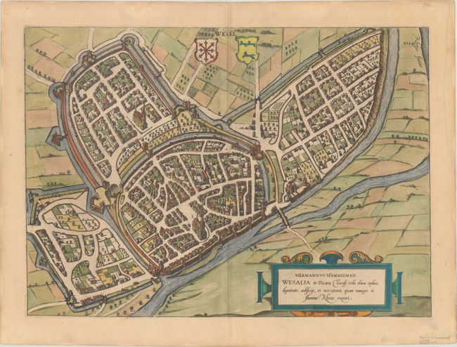
Braun & Hogenberg's Civitates Orbis Terrarum or "Cities of the World" was published between 1572 and 1617. Within the six volumes, 531 towns and cities were depicted on 363 plates, providing the reader with the pleasures of travel without the attendant discomforts. Braun wrote in the preface to the third book, "What could be more pleasant than, in one's own home far from all danger, to gaze in these books at the universal form of the earth . . . adorned with the splendor of cities and fortresses and, by looking at pictures and reading the texts accompanying them, to acquire knowledge which could scarcely be had but by long and difficult journeys?" Braun and Hogenberg incorporated an astonishing wealth of information into each scene beyond the city layout and important buildings. The plates provide an impression of the economy and prominent occupations, and illustrate local costumes, manners and customs.
This bird's-eye view of the German town of Wesel provides an interesting window into the past, allowing us to glimpse a town that was almost completely decimated by bombings during World War II. Located at the convergence of the Lippe and Lower Rhine, the city was of significant strategic importance, and, from the 13th to 15th centuries, it was an important cultural center, an essential trading stop connecting Cologne, the Netherlands, and Westphalia. The view shows the city's recently updated fortifications. It also includes an ornate title cartouche and two coats-of-arms. Latin text on verso.
References: Fussel, p. 285.
Condition: A
On a watermarked sheet with a tiny hole to the right of the centerfold at top, and remnants of hinge tape on verso.