Catalog Archive
Auction 174, Lot 467

"Plan de Paris et de ses Faubourgs en l'Etat quil Etoit en 1749", Le Rouge, George Louis

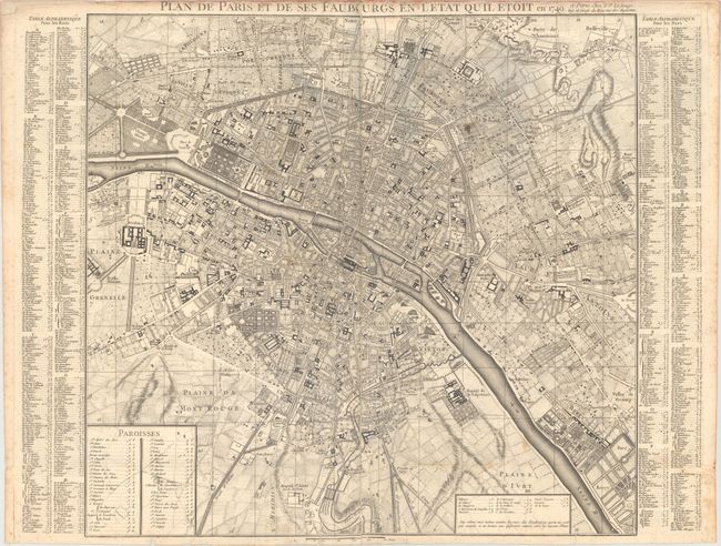
Subject: Paris, France

Period: 1749 (dated)

Publication:

Color: Black & White

Size:
21.4 x 20 inches
54.4 x 50.8 cm
Download High Resolution Image
(or just click on image to launch the Zoom viewer)

This uncommon and densely detailed bird's-eye plan of Paris and its immediate surroundings is divided into a grid to make the city more navigable. A key at bottom locates parishes, and there is an extensive alphabetical index at left and right that identifies street names. Notre Dame, Champs-Elysees, Tuileries Garden, Les Invalides, the Sorbonne, and many more notable sites are labeled.

References:

Condition: B

On a sheet with a rosary beads watermark. There are some light stains in the image and light scattered foxing that is mostly confined to the sheet's edges. A long separation along the centerfold has been repaired on verso with archival materials, and there are several tiny edge tears at the bottom of the sheet.

Estimate: $240 - $300

Sold for: $230

Closed on 9/11/2019

Archived