Catalog Archive
Auction 174, Lot 385

"A New and Accurate map of Europe Drawn from the Best Authorities, Assisted by the Most Approved Modern Charts & Maps, and Adjusted by Astronomical Observations", Bowen, Emanuel
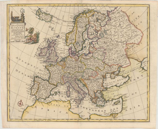
Subject: Europe

Period: 1744 (circa)

Publication: Navigantium atque Itinerantium Bibliotheca...

Color: Hand Color

Size:
17.5 x 14.5 inches
44.5 x 36.8 cm
Download High Resolution Image
(or just click on image to launch the Zoom viewer)

This well-engraved map of Europe includes Iceland and extends east to where the Volga River discharges into the Caspian Sea. The map is filled with political boundaries, cities, rivers, and a few topographical details. The title cartouche features a river god. Published in John Harris' Navigantium atque Itinerantium Bibliotheca. Or, a Complete Collection of Voyages and Travels...

References: Shirley (BL Atlases) G.HARR-1a #22.

Condition: A

A nice impression on a bright sheet with some minor extraneous creases and a couple of small holes in the top blank margin that have been archivally repaired.

Estimate: $200 - $230

Sold for: $150

Closed on 9/11/2019

Archived