Catalog Archive
Auction 174, Lot 382

"Europae", Ortelius, Abraham
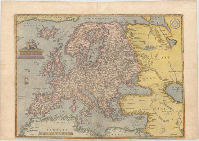
Subject: Europe

Period: 1571 (published)

Publication: Theatrum Orbis Terrarum

Color: Hand Color

Size:
18.4 x 13.5 inches
46.7 x 34.3 cm
Download High Resolution Image
(or just click on image to launch the Zoom viewer)

This handsome map was based on Gerard Mercator's 1554 map of Europe and incorporates Magnus' information on Scandinavia and Jenkinson's map for Russia. The map extends to include Iceland and part of Greenland, and there is a tiny bit of Labrador intruding into the map at upper left. It also extends into western Asia and Northern Africa based on Gastaldi's cartography. Finely engraved with a stippled sea and modestly adorned with a sailing ship, compass rose, and a tent encampment in Russia. The personification of Europa being abducted by Zeus in the form a bull graces the title cartouche. This is Ortelius' first map of Europe, which was replaced in 1584 with a new copper plate. Latin text on verso.

References: Van den Broecke #4.

Condition: B+

An early impression, printed on paper with the crossed arrows watermark commonly found on Ortelius' maps. There is light soiling and professional repairs along the centerfold at bottom to a small chip that just enters the border and to several worm tracks in the image, with a minor amount of image replaced in facsimile. The bottom margin is trimmed, but still ample for framing.

Estimate: $900 - $1,100

Sold for: $600

Closed on 9/11/2019

Archived