Catalog Archive
Auction 174, Lot 310

"Carte Reduite de l'Isle de Saint Domingue et de ses Debouquements pour Servir aux Vaisseaux du Roy...", Bellin, Jacques Nicolas
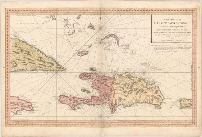
Subject: Hispaniola

Period: 1754 (dated)

Publication: L'Hydrographie Francoise

Color: Hand Color

Size:
34.9 x 21.8 inches
88.6 x 55.4 cm
Download High Resolution Image
(or just click on image to launch the Zoom viewer)

This gorgeous, large-scale chart covers Hispaniola, Turks & Caicos Islands, Lower Bahamas, the eastern ends of Cuba and Jamaica, and the western end of Puerto Rico. The mountainous terrain of the islands is vividly shown and the information includes the locations of settlements, roads, forts, reefs and harbors. This is the 1754 corrected edition, without the Depot de la Marine seal or price engraved on the map.

References:

Condition: B+

A nice example on a sturdy sheet with the watermark of a double-headed eagle with a heart. There is minor soiling and archival repairs to some separations along the centerfold.

Estimate: $600 - $750

Sold for: $375

Closed on 9/11/2019

Archived