Catalog Archive
Auction 174, Lot 309

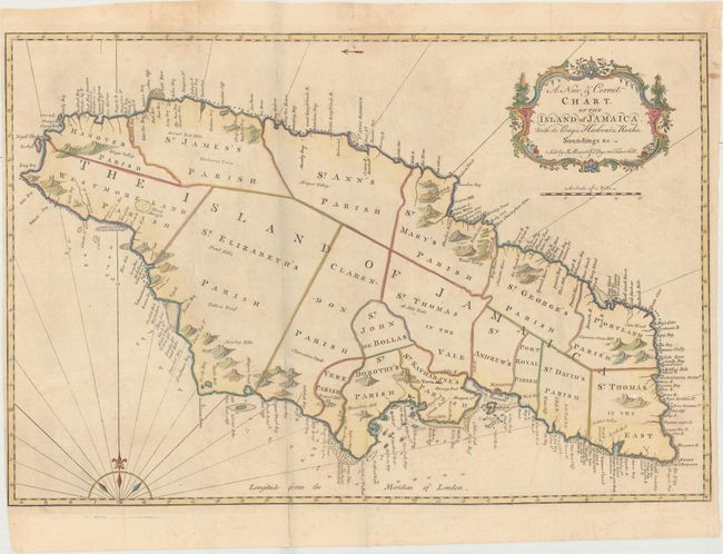
"A New & Correct Chart, of the Island of Jamaica. With Its Bays, Harbours, Rocks, Soundings &c.", Mount & Page

Subject: Jamaica

Period: 1773 (circa)

Publication: The English Pilot. The Fourth Book

Color: Hand Color

Size:
26.8 x 17.9 inches
68.1 x 45.5 cm
Download High Resolution Image
(or just click on image to launch the Zoom viewer)

This finely engraved map of Jamaica is primarily focused on coastal features with harbors, bays, shoals, anchorages and landmarks all carefully located. It also shows the parishes, towns, forts and major topographical features. Trelawny Parish is not shown, but Trelawny Town is noted. The cultivation of sugar cane and coffee made Jamaica one of Britain's most valuable possessions. It was also the site of several major slave uprisings throughout much of the 18th century and the British were constantly harassed by the Maroons, armed bands of freed slaves roaming the countryside.

References: Sellers & Van Ee #1922; Shirley (BL Atlases) M.M&P-5h #17.

Condition: B+

Light toning and offsetting with a few fold separations and a tiny tear in blank area of map image that have been closed on verso with Japanese tissue.

Estimate: $475 - $600

Sold for: $250

Closed on 9/11/2019

Archived