Catalog Archive
Auction 174, Lot 247

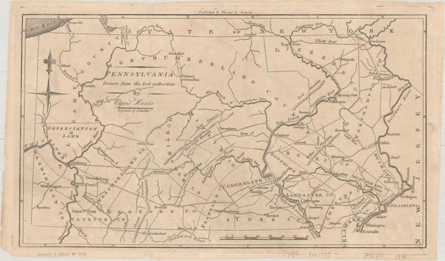
"Pennsylvania Drawn from the Best Authorities by Cyrus Harris", Morse, Jedidiah (Rev.)
Subject: Pennsylvania

Period: 1796 (circa)

Publication: The American Universal Geography

Color: Black & White

Size:
13.2 x 7.6 inches
33.5 x 19.3 cm
Download High Resolution Image
(or just click on image to launch the Zoom viewer)

This early American map of the state of Pennsylvania depicts early county boundaries, cities, towns, roads, portages, and rivers. A few mountain ranges are sketchily depicted, but there is little other topographical information. Just to the north of Pittsburgh is an area labeled Depreciation Land, a substantial track of desirable land that was sold in order to provide back pay to soldiers who served in the Revolutionary War. In the northwest corner, the Erie Triangle is shown as part of New York. Decorated with a compass rose at upper left and longitude measured from Philadelphia. The map was engraved by Amos Doolittle and published by Thomas and Andrews.

References: McCorkle (18th C. Geography Books) #304-9; Wheat & Brun #446; Maps (Phillips) p. 697.

Condition: B+

Issued folding with minor toning and offsetting. There are several small fold separations that have been closed on verso with both archival and hinge tape.

Estimate: $220 - $250

Sold for: $160

Closed on 9/11/2019

Archived