Catalog Archive
Auction 174, Lot 182

"[Lot of 2] Carte de la Riviere de Cook, dans la Partie N.O. de l'Amerique [and] Amer. Sep. Partie de l'Amerique Russe. No. 13",

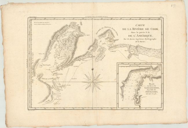
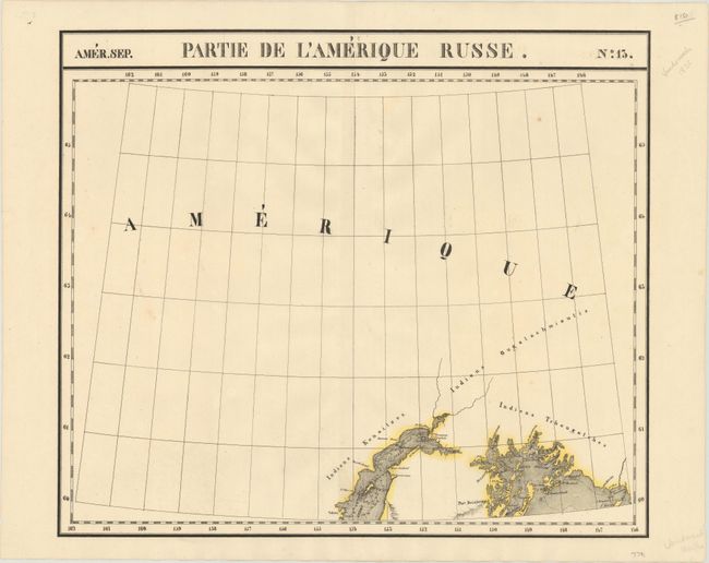
Subject: Southern Alaska

Period: 1787-1827 (circa)

Publication:

Color:

Size:
See Description
Download High Resolution Image
(or just click on image to launch the Zoom viewer)

Vandermaelen was the son of a wealthy industrialist who abandoned his father's business to follow a career in cartography. His goal was to produce the first atlas ever published in which every map was drawn on the same projection and to the same scale (1: 1,641,836), with each map covering an area of approximately 20 degrees of longitude (from Paris) and 6 degrees of latitude. Because of the consistent scale and projection, the maps could be joined together to form a huge globe that would measure over 25 feet in diameter. Vandermaelen had the only known globe constructed from his maps, requiring a special room for its display. It was also the first lithographic atlas ever published. There was one edition of the atlas, published in 1825-27, and the subscription list shows that only 810 copies were sold. Koeman called his Atlas Universel, "One of the most remarkable world atlases ever made. Far ahead of its time."

A. Carte de la Riviere de Cook, dans la Partie N.O. de l'Amerique, by Rigobert Bonne, from Atlas Encyclopedique..., circa 1787, black & white (13.6 x 9.3"). This handsome map shows Capt. Cook's discoveries in Prince William Sound and Cook Inlet and includes the track and anchor points of the Resolution. The map is inset with Plan du Havre de Samganoodha, dans l'Isle de Oonalaska. A large compass rose dominates the center. Drawn by Bonne and engraved by Andre. Condition: On a watermarked sheet with light soiling. (B+)

B. Amer. Sep. Partie de l'Amerique Russe. No. 13, by Philippe Marie Guillaume Vandermaelen, from Atlas Universel, published 1825-27, hand color (22.1 x 18.9"). This map zeroes in on the areas around Cook Inlet and Prince William Sound. It locates Port Bainbridge and several islands, including Knight, Montague, Hinchinbrook, and Hawkins. The map also identifies three native tribes: the Kenaitzes, Ougatachmioutis, and Tchougatches. There is no detail outside of the coastal areas.

The Atlas Universel was the first atlas to present all the maps on the same scale (1: 1,641,836), with each map covering an area of approximately 20 degrees of longitude (from Paris) and 6 degrees of latitude. The atlas was also the first lithographic atlas ever published. There was only one edition, published in 1825-27, and the subscription list shows that 810 copies were sold. Condition: A crisp impression with a few minor spots. (A)

References:

Condition:

See description above.

Estimate: $190 - $220

Sold for: $130

Closed on 9/11/2019

Archived