Catalog Archive
Auction 174, Lot 177

Gone Fishing! NO RESERVE

"[Lot of 2] Map of Yellowstone National Park... [and] Map of Western Montana...",

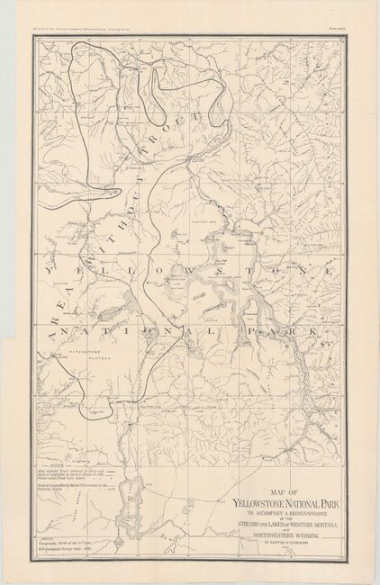
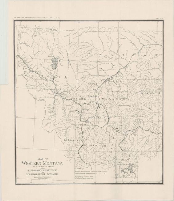
Subject: Northwestern United States, Yellowstone

Period: 1891 (dated)

Publication:

Color: Black & White

Size:
See Description
Download High Resolution Image
(or just click on image to launch the Zoom viewer)

These two maps were issued in Barton Evermann's report on the viability of establishing a fish hatchery in the Rocky Mountains, as requested by Congress. It was published as part of a Bulletin of the U.S. Fish Commission for 1891 and printed in 1893.

A. Map of Yellowstone National Park to Accompany a Reconnaissance of the Streams and Lakes of Western Montana and Northwestern Wyoming, (12.9 x 21.4"). Roughly centered on Yellowstone Lake, this map shows the route that Evermann took in exploring the region. Small black dots indicate where trout were caught and a large region surrounded by a heavy line indicate an "area without trout." The base map was taken from an 1886 USGS map of the region.

B. Map of Western Montana to Accompany a Report upon Explorations in Montana and Northwestern Wyoming, (12.7 x 14.0"). A similar map that extends from Yellowstone north to Missoula and east to Lewiston. A dotted line indicates the route of exploration and small dots show where work was done. The base map was taken from a General Land Office map of 1887.

References:

Condition: A

Issued folding on bright, clean sheets with a few minor fold separations mostly at the fold junctions.

Estimate: $40 - $60

Sold for: $50

Closed on 9/11/2019

Archived