Catalog Archive
Auction 174, Lot 174

"Map of the Yellowstone and Missouri Rivers and Their Tributaries", U.S. War Department

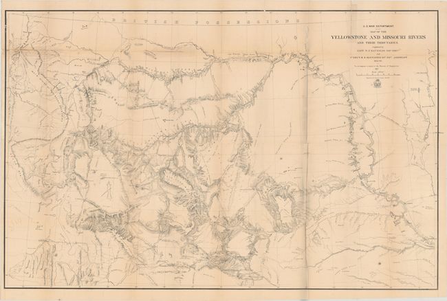
Subject: Western United States

Period: 1867 (dated)

Publication:

Color: Black & White

Size:
41.6 x 26.9 inches
105.7 x 68.3 cm
Download High Resolution Image
(or just click on image to launch the Zoom viewer)

A large and very detailed map of the region explored by Capt. W.F. Raynolds in 1859-60. His report was delayed until 1866 due to the outbreak of the Civil War which sent him and his assistants off to war. While he was away, he came down with a "severe and protracted illness" which caused further delays. It was eventually completed when mining developments and conflicts with Indian tribes in the region made it important. The map includes post 1860 developments such as Ft. Casper and Camp Marshall on the upper North Platte, as well as the Tetons, Jackson's Hole, and several new forts and emigrant roads.

References: Phillips (Maps) p. 1130.

Condition: B

Issued folding with light toning and a number of fold separations that have been mostly closed on verso with a combination of archival and non-archival tape. There are two tiny areas of loss in unengraved areas of the map at top and some minor staining from the use of non-archival tape that shows through on recto along the upper fold.

Estimate: $375 - $450

Sold for: $240

Closed on 9/11/2019

Archived