Catalog Archive
Auction 174, Lot 16

Ritter's Circular Sundial World Map

"[Untitled - World]", Ritter, Franz
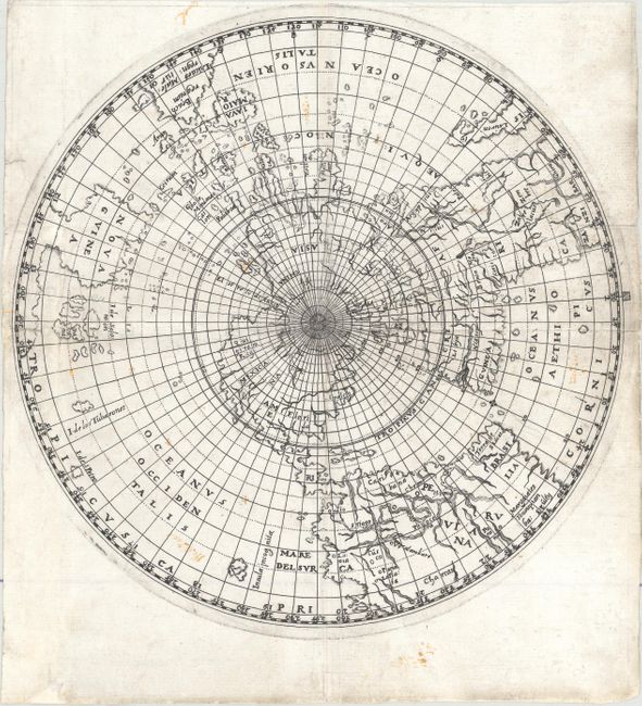
Subject: World

Period: 1613 (circa)

Publication: Astrolabium…

Color: Black & White

Size:
8.1 x 8.1 inches
20.6 x 20.6 cm
Download High Resolution Image
(or just click on image to launch the Zoom viewer)

This scarce and extremely unique map shows the world projected from the North Pole as if it were the table of a sundial. The landmasses are drawn to scale in proportion to their distance from the pole. The result is a very distorted, though mathematically correct, projection. The river systems in South America and Africa are quite enlarged, with the source of the Nile depicted as twin lakes south of the equator. The cartography in the South Pacific is quite conjectural, with a landmass south of Iava Maior with the coastal name of Beach regnum, and an enlarged Nova Guinea attached to another large landmass.

References: Shirley #282.

Condition: B+

A nice impression on a bright sheet with light soiling and a few old manuscript notations. There are professional repairs to several short separations along the folds, a couple of short tears, and a small hole in Nova Guinea with a minor amount of image replaced in facsimile.

Estimate: $1,500 - $1,900

Sold for: $900

Closed on 9/11/2019

Archived