Catalog Archive
Auction 174, Lot 159

Speed's Map of the Carolinas Based Upon the Lords Proprietor's Map

"A New Description of Carolina", Speed/Lamb

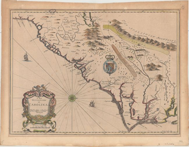
Subject: Colonial Southeastern United States

Period: 1676 (circa)

Publication: A Prospect of the Most Famous Parts of the World

Color: Hand Color

Size:
20.1 x 14.8 inches
51.1 x 37.6 cm
Download High Resolution Image
(or just click on image to launch the Zoom viewer)

This striking map of the Southeast region was based on the landmark Lords Proprietor's Map of 1672 by Ogilby/Moxon. It incorporates information from a number of early accounts including Lederer, Hilton, Sandford, Ashley-Cooper, and Culpeper. Oriented with north to the right as indicated by the compass rose, the map covers the region from St. Augustine to Cape Charles and Jamestown with detail focused along several rivers. The fictitious Ashley Lake, Deserta Arenosa, and a Savana east of the Apalathean Mountains are of particular interest. It is artistically embellished with graphic mountain ranges, the arms of Charles II, ships, and a title cartouche with a fishing putto. English text on verso contains an interesting account of John Lederer's important explorations. Speed's atlas was the first world atlas produced wholly in England. It was first published in 1627 without any maps of the American colonies. It was not until the last edition (47 years after Speed's death), by Thomas Bassett and Richard Chiswell, that the new maps of America, engraved by Francis Lamb, were added.

References: Cumming (SE) #77; Goss (NA) #41; Shirley (BL Atlases) T.SPE-2f #26.

Condition: B+

On fleur-de-lis watermarked paper with light mat burn just outside of the platemark and some minor foxing in the image. A small chip in the right blank margin has been reattached with archival material on verso. Remnants of paper tape on verso.

Estimate: $3,000 - $3,750

Sold for: $2,000

Closed on 9/11/2019

Archived