Catalog Archive
Auction 174, Lot 153

"Carte de la Virginie, du Maryland et de l'Etat de Delaware", Brion de la Tour, Louis

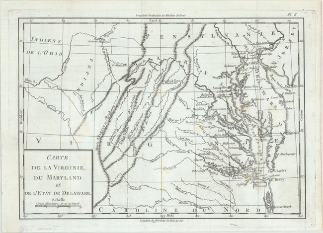
Subject: Colonial Mid-Atlantic United States

Period: 1782 (published)

Publication: Essais Historiques et Politiques sur les Anglo-Americains

Color: Black & White

Size:
12.8 x 9 inches
32.5 x 22.9 cm
Download High Resolution Image
(or just click on image to launch the Zoom viewer)

This map appeared as plate 5 in Michel Rene Hilliard d'Auberteuil's Essais Historiques et Politiques sur les Anglo-Americains. It covers the region from the Virginia/North Carolina border north to Philadelphia and Fort Pitt Ci Devant du Quesne. Directly to the south of Fort Pitt is an area of land labeled Indiana despite the fact that the map pre-dates the creation of the Indiana Territory in 1800 (likely a reference to the Indiana Company). Settlement is confined to the east of the Blue Ridge Mountains with the exception of Frederick Town ou Winchester. The map provides basic topography and a good rendering of the river systems in the region. Decorated by a simple block-style cartouche in the lower left corner.

References:

Condition: B+

Issued folding with some light stains and faint offsetting. A binding trim at lower left has been replaced with old paper.

Estimate: $250 - $325

Sold for: $210

Closed on 9/11/2019

Archived