Catalog Archive
Auction 174, Lot 148

First Edition

"Nova Virginiae Tabula", Mercator/Cloppenburgh

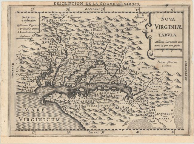
Subject: Colonial Mid-Atlantic United States

Period: 1630 (circa)

Publication: Gerardi Mercatoris Atlas sive Cosmographicae Meditationes...

Color: Black & White

Size:
10 x 7.3 inches
25.4 x 18.5 cm
Download High Resolution Image
(or just click on image to launch the Zoom viewer)

This delicately engraved map is a reduced version of John Smith's map of the Chesapeake Bay region (fourth derivative). Despite its small size, it is filled with towns with both English and Native names, including Jamestown (Iamestowne), and a key to the types of buildings on the left and pictorial topography. Engraved by Pieter van den Keere with his Latinized name appearing below the title cartouche. In this Cloppenburg edition, Keere increased the map size from 5 x 7" to 7 x 10" inches. This is the first edition with French text on verso, published between 1630-1636.

References: Burden #226; Tooley (America) plt. 72; Van der Krogt (Vol. III) #9410:353.

Condition: B+

A dark impression with a few faint spots. The sheet has been backed with tissue and remargined at bottom with a small portion of the border drawn in facsimile.

Estimate: $750 - $900

Unsold

Closed on 9/11/2019

Archived