Catalog Archive
Auction 173, Lot 468

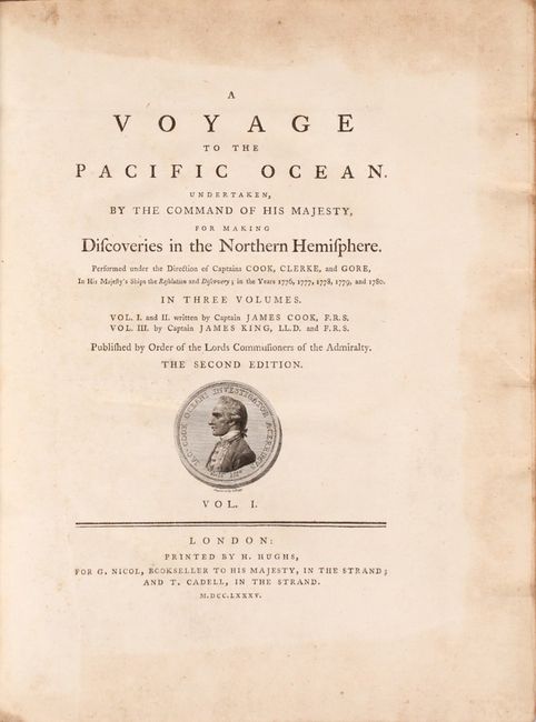
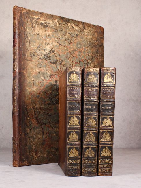
Second Edition of Cook's Third Voyage to the Pacific Ocean

"[3 Volumes with Atlas] A Voyage to the Pacific Ocean. Undertaken, by the Command of His Majesty, for Making Discoveries in the Northern Hemisphere", Cook, James (Capt.)

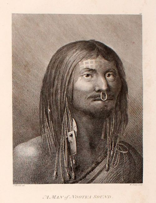
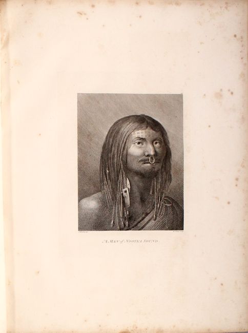
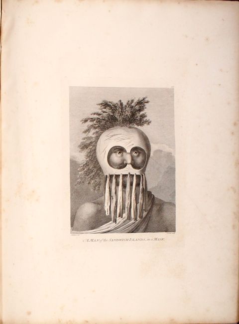
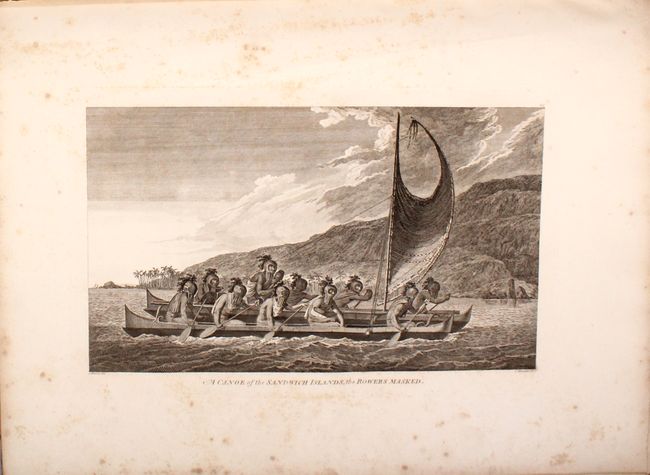
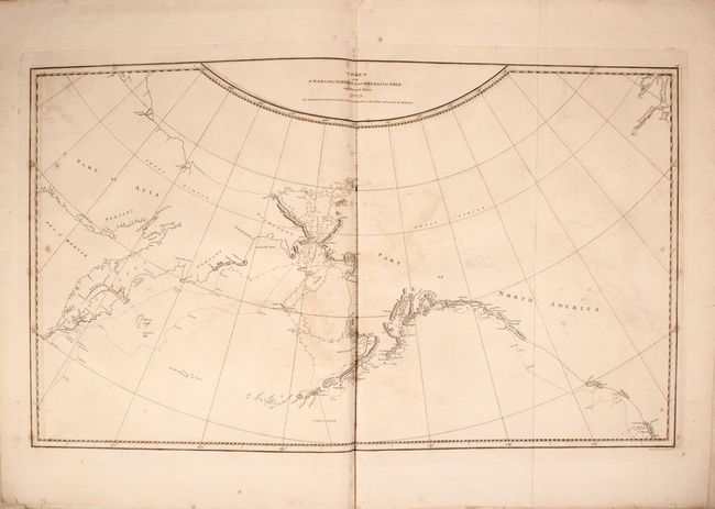
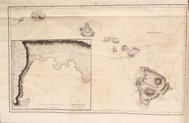
Subject: Exploration & Surveys, Pacific Ocean

Period: 1785 (published)

Publication:

Color: Black & White

Size:
9.8 x 12.3 inches
24.9 x 31.2 cm
Download High Resolution Image
(or just click on image to launch the Zoom viewer)

Captain James Cook (1728-1779) is best known for his three voyages to the Pacific (1768-71; 1772-75; and 1776-79). His discoveries radically changed the western understanding of the world in the late 18th century. He was the first to circumnavigate and chart New Zealand and provided the earliest European accounts of exploration along the eastern coast of Australia and the Hawaiian Islands. On February 14th, 1779, he was killed on Hawaii after attempting to kidnap the chief of the island.

Many contemporary accounts of Cook’s voyages, including charts and engravings, appeared in the late 18th century. The first official account of Cook’s first voyage was published in 1773 by John Hawkesworth in Volumes II and III of An Account of the Voyages Undertaken by the Order of His Present Majesty for Making Discoveries in the Southern Hemisphere... William Strahan and Thomas Cadell published the first official accounts of the second and third voyages in 1777 and 1784. Accounts of his exploration were subsequently translated into French, German, and Dutch.

This is the desirable and complete second edition of Cook's third voyage accompanied by the large atlas. His third (and final) expedition was organized to continue the British exploration of the Pacific, seek out the famous Northwest Passage, and to return Omai, a Tahitian native brought to London at the end of the second voyage, to his home. Leaving England in 1776, the expedition stopped at Kerguelen Island, Tasmania, New Zealand, the Cook, Tonga and Society islands. Cook then sailed north and discovered Christmas Island and the Hawaiian islands. The expedition continued to the Northwest Coast of North America from the Bering Straits along the coast of Alaska and Canada, as far south as northern California. The expedition returned to Hawaii in 1778 where a tragic series of events lead to the death of Capt. Cook. The expedition continued under Captains Clerke and Gore, exploring the coasts of Siberia and Kamchatka, finally reaching England in 1780. Some of the officers serving with Cook included several men who became famous in their own right: William Bligh, James Burney, James Colnett, George Vancouver, and the expedition's artist John Webber.

The accompanying elephant folio atlas (17 x 22") includes 61 splendid plates by John Webber depicting natives, local customs, and scenes along the expedition. The atlas also includes the following two important maps:

A General Chart: Exhibiting the Discoveries Made by Captn. James Cook in this and His Two Preceding Voyages; with the Tracks of the Ships Under His Command (35.8 x 22.9"). This large map on Mercator's projection was compiled by Lieut. Henry Roberts. The map is centered on Australasia with the routes of the Endeavour (1768-71) and Resolution (1772-75 and 1776-80) illustrated with occasional notes along the tracks. Roberts began his compilation under Cook's supervision and completed it after Cook's death. Engraved by W. Palmer.

Chart of the NW Coast of America and NE Coast of Asia Explored in the Years 1778 & 1779 (26 x 15.2"). This map shows the coastline of northwestern North America and northeastern Asia, with particular emphasis on Bristol Bay north to the Bering Strait. The detail is focused on Cook's explorations with his tracks shown with dotted lines. Engraved by G. Byrne.

Hardbound in quarter leather with tips over marbled boards.

The three volumes of text include 23 additional plates including 17 maps (many folding) and 6 plates of coastal approaches. Of particular interest here is the Chart of the Sandwich Islands, which is the first printed map of Hawaii. The map is a landmark in Hawaiian cartography and provided the basis for all subsequent mapping of the islands. Volume I (421 pages) and II (548 pages) were written by Cook, while volume III (556 pages) was written by Captain James King. Hardbound in full contemporary leather with raised bands and gilt title and embellishments on the spine.

References: Howes #C-729a; Sabin #16250; Streeter #3478.

Condition:

The atlas volume is overall good to very good with light to moderate scattered foxing throughout. In addition to the foxing, the large "General Chart" has some light toning where the map was adhered to the backstrap, and the map of the northwest coast of America has light offsetting. No title page is present in the atlas. Covers are moderately worn and rubbed along the edges. Spine has been rebacked with portions of the original label pasted on top. The contents of the text volumes are overall near fine with occasional spots of foxing and the last 50 pages of volume I has a dampstain in the bottom blank margin. Bindings of the text volumes have some wear and abrasions to the leather, and there are some small chips to the spine labels. Atlas (B)/Text Volumes (B+)

Estimate: $9,000 - $11,000

Sold for: $6,500

Closed on 6/5/2019

Archived