Catalog Archive
Auction 173, Lot 332

"Exactissima Totius Archipelagi nec non Graeciae Tabula in qua Omnes Subjacentes Regiones et Insulae Distincte Ostenduntur", Visscher, Nicolas
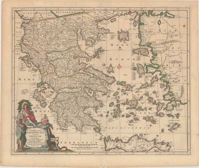
Subject: Greece

Period: 1690 (circa)

Publication:

Color: Hand Color

Size:
22.2 x 18.3 inches
56.4 x 46.5 cm
Download High Resolution Image
(or just click on image to launch the Zoom viewer)

This scarce map of Greece and the islands in the Aegean includes Crete and part of the Turkish coastline. The map is densely engraved with detail and beautifully embellished with a large title cartouche composed of symbols of ancient Greek civilization.

References: Zacharakis #2350.

Condition: B+

Full contemporary color with light soiling, a small stain at top right, and an archivally repaired centerfold separation that only enters the image 1" at top. There are small, old glue remnants along the top edge of the sheet on verso, and a short repaired tear in the top blank margin.

Estimate: $475 - $600

Sold for: $350

Closed on 6/5/2019

Archived