Catalog Archive
Auction 173, Lot 171

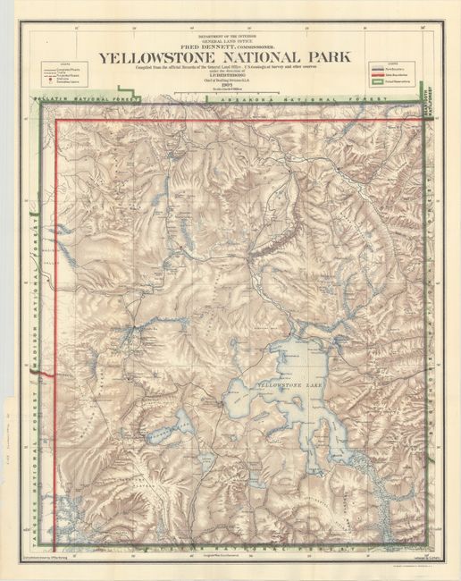
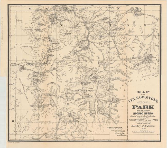
"[Lot of 2] Yellowstone National Park Compiled from the Official Records of the General Land Office... [and] Map of the Yellowstone National Park with the Adjacent Hoodoo Region...", U.S. Government

Subject: Yellowstone, Wyoming

Period: 1880-1909 (dated)

Publication:

Color:

Size:
See Description
Download High Resolution Image
(or just click on image to launch the Zoom viewer)

A. Yellowstone National Park Compiled from the Official Records of the General Land Office, U.S. Geological Survey and Other Sources, dated 1909, printed color (20.1 x 25.6"). A well-colored and finely engraved map filled with many details, showing all rivers and streams, waterfalls, lakes, roads, and trails. The legend further delineates the Snowshoe Cabins, Stations, and differentiates between trails and roads. It locates all of the geyser basins plus it names scores of individual geysers. The recently constructed Old Faithful Lodge is on the map simply as "Hotel." This famous landmark was constructed in three phases between 1903 and 1927. At this stage, only the original section (known today as the Old House) was completed. The effect of stone lithography is evident in the depiction of contour with stipple-style shading. This most handsome map of the park was completed during Fred Dennett's term as Commissioner to the General Land Office. Compiled and drawn by I.P. Berthrong and lettered by C.J. Helm. Condition: Issued folding with a few tiny splits at fold intersections. (A)

B. Map of the Yellowstone National Park with the Adjacent Hoodoo Region Compiled from the Official Explorations and Surveys of the Superintendent of the Park..., from House Ex. Doc. No 1 Part 5, dated 1880, black & white (17.4 x 15.7"). This map is roughly centered on Yellowstone Lake and shows the "Hoodoo" or Goblin Mountain to the east of the park. This area was given its name for the giant rocks that jut up to 60 feet in the air and have a ghostly appearance. Shows the "Route of Exploration" from the Indian Lodges just outside of the eastern park boundary to the Hot Springs. While dated 1880, this map was likely a later printing (circa 1900). Condition: Issued folding with light toning along the fold lines and a 1.5" binding tear at left that has been closed on verso with tape. (B+)

References:

Condition:

See description above.

Estimate: $150 - $180

Sold for: $210

Closed on 6/5/2019

Archived