Catalog Archive
Auction 173, Lot 161

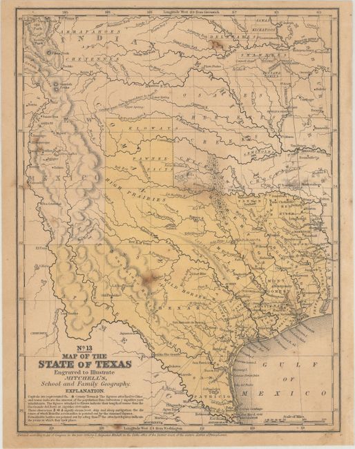
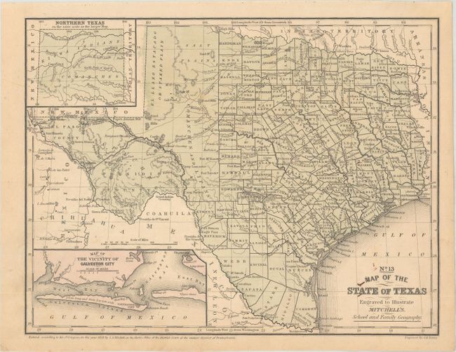
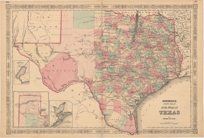
"[Lot of 3] No. 13 Map of the State of Texas Engraved to Illustrate Mitchell's, School and Family Geography [and] No. 13 Map of the State of Texas... [and] Johnson's New Map of the State of Texas",

Subject: Texas

Period: 1846-65 (circa)

Publication:

Color: Hand Color

Size:
See Description
Download High Resolution Image
(or just click on image to launch the Zoom viewer)

A. No. 13 Map of the State of Texas Engraved to Illustrate Mitchell's, School and Family Geography, by Samuel Augustus Mitchell, dated 1846 (7.9 x 10.4"). This map features an early rending of the final borders of the new State of Texas. This is from the series that was the first to name Dallas. Indian tribes, forts, wagon roads, mines and more are noted. The Alamo is located as Ft. Alamo. County development has extended to about 99° N. latitude at Gonzales and Gollard counties. The map is dated 1846, but it was likely published closer to 1848. Condition: Lightly toned with a few spots of foxing. (B+)

B. No. 13 Map of the State of Texas Engraved to Illustrate Mitchell's School and Family Geography, by Samuel Augustus Mitchell, dated 1858 (10.5 x 8.1"). Fine map of Texas filled with a remarkable amount of information for a school atlas map. Details include Indian tribes, watershed, counties, cities and towns, wagon roads or trails, and more. The Salt Plains lay to the east of the Staked Plain, and much of central Texas is labeled Rolling Table Lands. The hills are shown through hachure. With insets of the panhandle and the vicinity of Galveston. Engraved by J.H. Young. Condition: (A)

C. Johnson's New Map of the State of Texas, by Johnson and Ward, circa 1865 (24.6 x 16.8"). Large, handsome map with county development mostly in eastern Texas and only the three large counties of El Paso, Presidio, and Bexar in the west. The panhandle, noted as the Staked Plain (Elevated Table Land, without Wood or Water), includes a large section that is unorganized. Features nice depiction of the wagon roads, many named, with several completed railroads. The US Mail Route is delineated on earlier editions, curiously missing here. Insets include a Plan of Sabine Lake, Plan of the Northern part of Texas, and Plan of Galveston Bay. County development is current to 1864 with Coleman County present (1864) but Hood is not (1866). Condition: Pleasant light toning and a few spots of foxing. (B+)

References:

Condition:

See description above.

Estimate: $275 - $350

Sold for: $170

Closed on 6/5/2019

Archived