Catalog Archive
Auction 172, Lot 354

"An Accurate Map of Paraguay, Tucumania, Chaco, Rio de la Plata, &c. with Part of Brasil...", Bowen, Emanuel

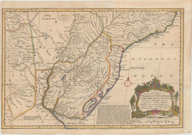
Subject: Central South America

Period: 1759 (circa)

Publication: General Magazine of Arts and Sciences

Color: Hand Color

Size:
16.8 x 11.3 inches
42.7 x 28.7 cm
Download High Resolution Image
(or just click on image to launch the Zoom viewer)

An interesting copper engraved map showing considerable detail throughout the region. Locates scores of rivers and numerous towns and villages. A long notation discusses the Jesuit settlements in Paraguay and notes that the native population of about 300,000 families has been reduced into a "State of absolute Subjection and Slavery to their present Tyrannical masters the Jesuits." Simple compass rose and decorative cartouche. This map appeared in both General Magazine of Arts and Sciences and Miscellaneous correspondence, containing a variety of subjects relative to natural and civil history, geography, mathematics, poetry, memoirs of monthly occurrences..., both published by Benjamin Martin.

References: McCorkle (18th C. Geography Books) #255-3.

Condition: B+

Issued folding, now flattened on paper with a "W" watermark. There is light soiling, minor toning, and a narrow left margin. Remargined at top, and a binding trim at right has also been professionally replaced.

Estimate: $200 - $230

Unsold

Closed on 4/17/2019

Archived