Catalog Archive
Auction 172, Lot 284

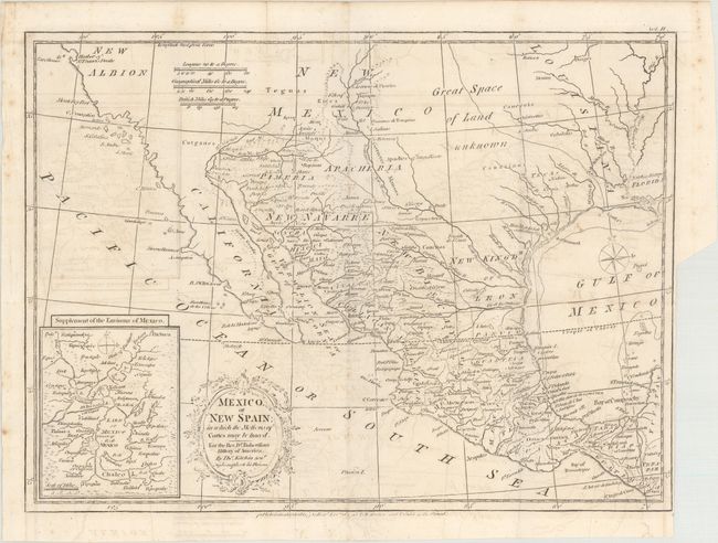
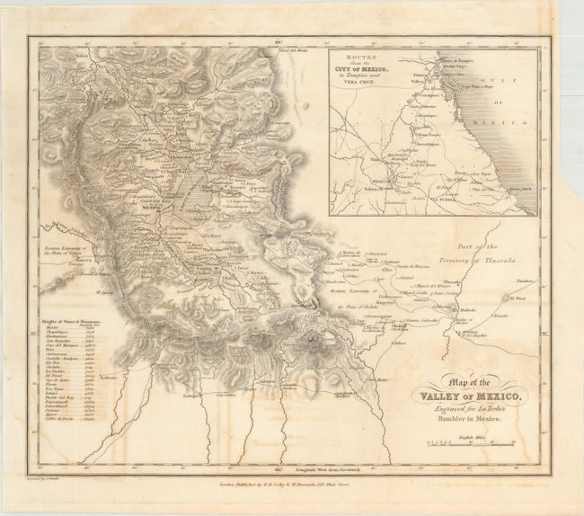
"[Lot of 3] Le Nouveau Mexique avec la Partie Septentrionale de l'Ancien ou de la Nouvelle Espagne [and] Mexico, or New Spain; in Which the Motions of Cortes May Be Traced... [and] Map of the Valley of Mexico...",

Subject: Southern United States & Mexico

Period: 1780-1836 (circa)

Publication:

Color:

Size:
See Description
Download High Resolution Image
(or just click on image to launch the Zoom viewer)

A. Le Nouveau Mexique avec la Partie Septentrionale de l'Ancien ou de la Nouvelle Espagne, by Rigobert Bonne, circa 1780, hand color (12.6 x 8.3"). This small and attractive map details the region from West Florida through California and northern Mexico. In Texas, there is a city named Texas and a notation concerning the death of the explorer La Salle. There is excellent detail, particularly of the Jesuit missions in Mexico and the Southwest. In present-day Arizona, the Gila River is named Rio de los Apostolos. The map is filled with place names and Indian villages, particularly in today's Arizona and New Mexico. The Baja peninsula is wildly misshapen. Condition: There is a light dampstain along the centerfold.

B. Mexico, or New Spain; in Which the Motions of Cortes May Be Traced. For the Rev. Dr. Robertson's History of America, by Thomas Kitchin, from Rev. Dr. Robertson's History of America, dated 1795, black & white (15.1 x 11.3"). This is a very attractive map of the American Southwest and Mexico. California is labeled New Albion with no detail outside of a few coastal place names. The region of present-day Arizona and New Mexico is well delineated with numerous Indian villages and the locations of missions. The area from New Mexico to Louisiana is named as "Great Space of Land Unknown." The small Texas settlement of Cenis is near the New Kingdm. of Leon. An inset shows Mexico City on the large Lake of Mexico. Finely engraved with a decorative title cartouche and compass rose. This map was originally published in 1777, this being the 1795 edition by W. Strahan and T. Cadell. Condition: Issued folding with light offsetting and a binding trim at lower right.

C. Map of the Valley of Mexico, Engraved for LaTrobe's Rambler in Mexico, by R.B. Seeley and W. Burnside, circa 1836, black & white (11.3 x 9.6"). Detailed map of the Valley of Mexico with Mexico City and Laguna de Tescuco at center. Shows excellent topography with a key identifying the elevation of various towns and mountains. Includes an inset of routes from Mexico City to the Gulf of Mexico. Condition: Issued folding with light offsetting and a binding trim at top right.

References:

Condition: B+

See description above.

Estimate: $300 - $375

Sold for: $150

Closed on 4/17/2019

Archived