Catalog Archive
Auction 171, Lot 769

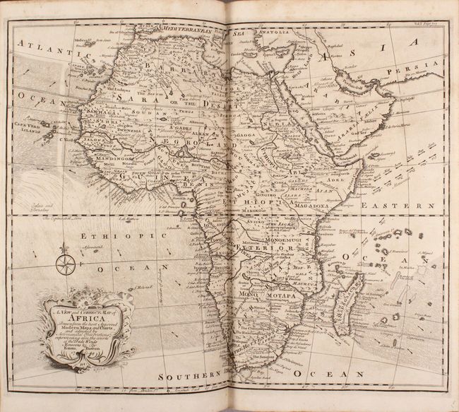
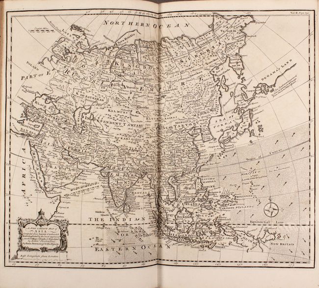
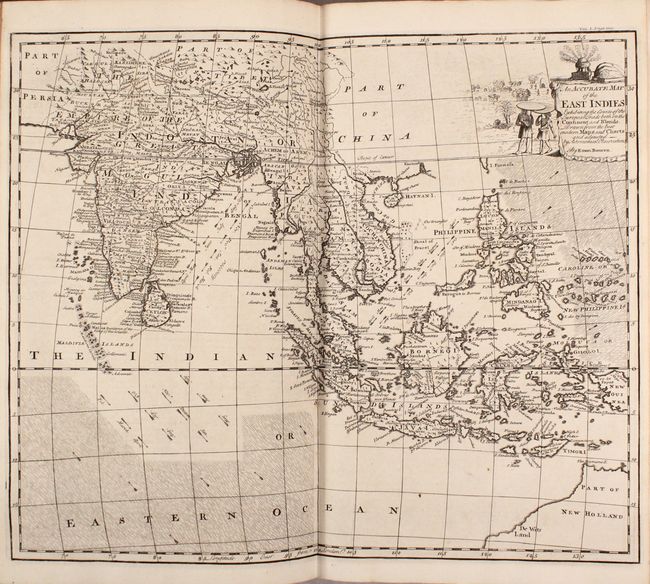
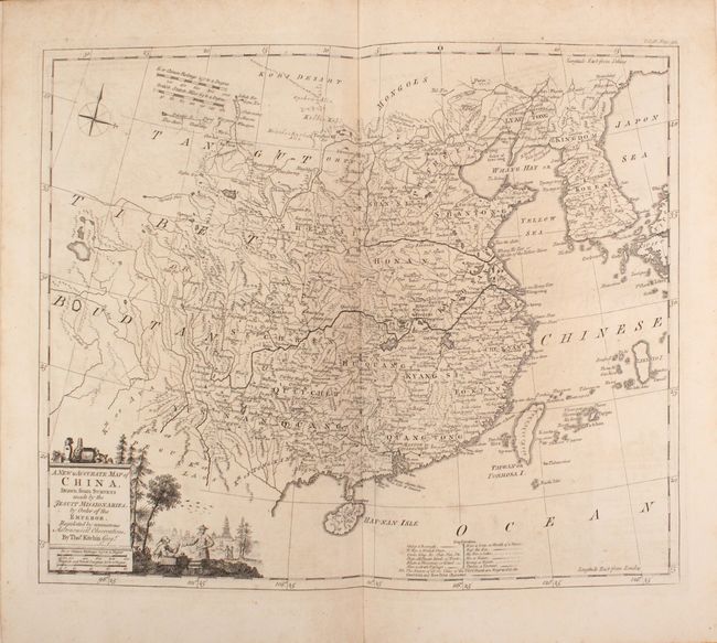
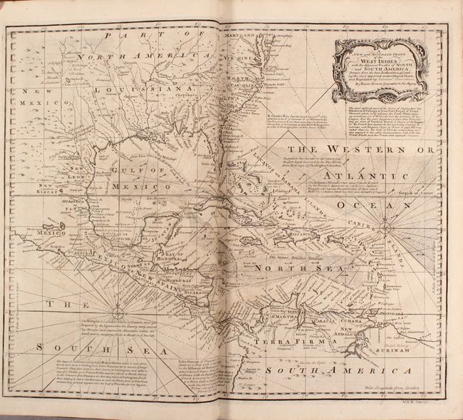
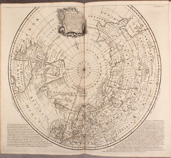
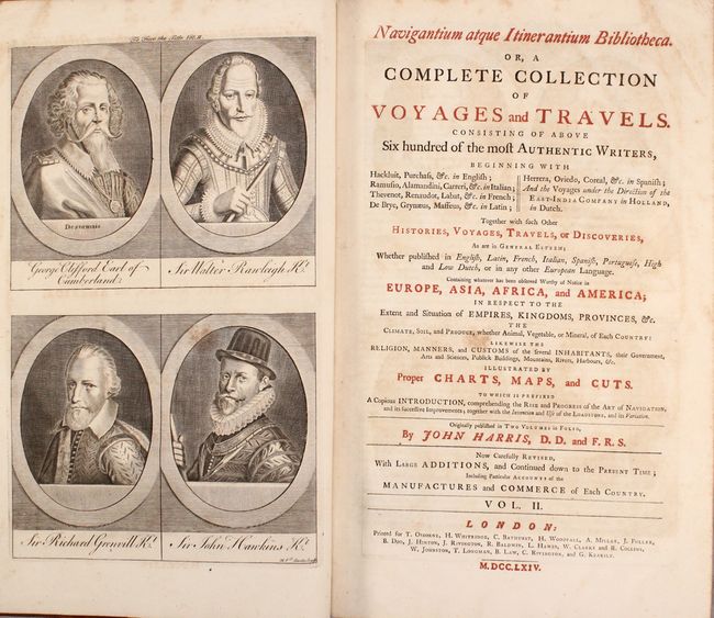
Harris' Important Collection of Voyages with 61 Maps and Plates

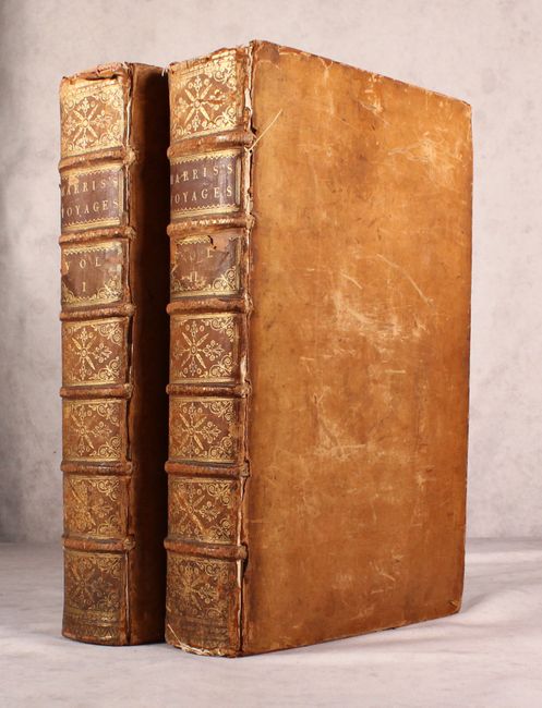
"[2 Volumes] Navigantium Atque Itinerantium Bibliotheca. Or, a Complete Collection of Voyages and Travels...", Harris, John

Subject: Exploration & Surveys

Period: 1764 (published)

Publication:

Color: Black & White

Size:
10.7 x 16.6 inches
27.2 x 42.2 cm
Download High Resolution Image
(or just click on image to launch the Zoom viewer)

First published in 1705 with few maps, John Harris' Navigantium was revised and enlarged for the 1744-48 edition, and published again in 1764. This important collection includes the voyages of Magellan, Drake, Cavendish, Schouten, Hawkins, Narbrough, Dampier, and Anson, among others. There are a total of 30 maps and 31 other plates of Natives, views, buildings, flora and fauna, and portraits. Many of the maps were engraved by Emanuel Bowen, including two maps of the world and maps of each of the four continents. One of the notable maps is Bowen's scarce and important early map of Georgia, which shows the colony shortly after its founding and notes coastal settlements, Indian villages and forts, and major roads. Another important and rare Bowen map shows New Holland and the discoveries of Captain Abel Tasman, and was the first English map to focus on Australia. Copied from Melchissedec Thevenot's map of 1663, the map shows the known coastlines of Australia, New Guinea and New Zealand and includes two long notes, one of which explains that Terra Australis is "no longer incognita." The maps are:

1. A New and Correct Chart of all the Known World
2. A New and Accurate Map of the World ... Describing the Course of each of the Following Circum-Navigators...
3. The Gallapagos Islands
4. A Map of the Discoveries Made by Capt. Willm. Dampier
5. A Plan of Lima [on sheet with] Potosi
6. A Prospect of the Town of Batavia [on sheet with] A View of the Citadel of Batavia
7. A Complete Map of the Southern Continent Survey'd by Capt. Abel Tasman
8. A View of the Town and Castle of Macao
9. A Plan of the City of Canton on the River Ta Ho
10. India ... Before the Fifth Century
11. A Map of Marco Polo's Voyages and Travels in the 13th Century Through ... Asia, all Tartary, the East India Islands & Part of Africa
12. An Accurate Map of the East Indies
13. A New and Correct Map of Africa
14. A Map of India on the West Side of the Ganges
15. A New and Accurate Map of America
16. A New & Accurate Chart of the Western or Atlantic Ocean
17. A New and Accurate Chart of the West Indies
18. Antient Mexico
19. The City of St. Salvador and its Harbour
20. A New Map of Georgia, with Part of Carolina, Florida and Lousiana
21. A Correct Draught of the North Pole
22. A New and Accurate Map of Europe
23. A Prospect of the City of Genoa
24. A New & Exact Map of Asia
25. An Accurate Chart of the Mediterranean and Adriatic Seas
26. An Accurate Map of Morea
27. A New & Accurate Map of the Whole Russian Empire
28. A New & Accurate Map of China
29. Plans of the Old & New City of Peking ye Metropolis of China
30. An Exact Chart of all the Countries through which Capt. Behring Travelled from Tobolski Capital of Siberia to the Country of Kamtschatka

Large folio; Vol. I: pp. (8), xvi, (4), 984, 14 maps and 13 plates; Vol. II: (10), 1056, Index, 16 maps and 18 plates. Hardbound in full calf with raised bands, gilt tooling, and red leather labels with gilt titling on spine.

References: Sabin #30483; Shirley (BL Atlases) G.HARR-1d.

Condition: B+

Maps and plates are in very nice condition with minor toning and occasional soiling or foxing. The map of Australia was trimmed at the sides by the bookbinder to fit in the volume, with loss of part of the neatline and a minute amount of the image. Text is very good with light toning, soiling, and foxing. There are extraneous creases in Volume I to the title page, first few pages of text, and last few pages of text. The hinges are nearly perished, which is common for such large and heavy books, but the text block is otherwise solid. The covers have some abrasions, soiling, and bumped corners. The spine is cracking with a few small chips.

Estimate: $7,500 - $9,000

Sold for: $5,250

Closed on 2/6/2019

Archived