Catalog Archive
Auction 171, Lot 695

"The Coast of India from Mount Dilly to Pondicherry, Including the Coasts of Malabar, Madura and Part of Coromandel...", Laurie & Whittle

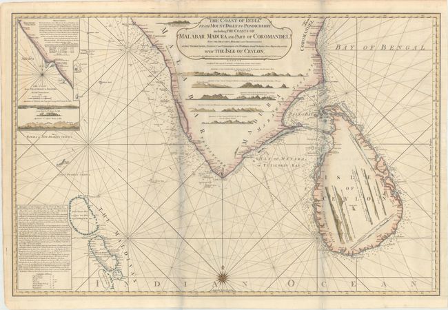
Subject: Southern India & Sri Lanka

Period: 1794 (dated)

Publication: A New and Elegant Imperial Sheet Atlas

Color: Hand Color

Size:
34.4 x 22.8 inches
87.4 x 57.9 cm
Download High Resolution Image
(or just click on image to launch the Zoom viewer)

This rare, large-scale chart depicts the Malabar, Madura, and part of the Coromandel coasts of southern India along with Sri Lanka. There is excellent navigational detail with hundreds of soundings, rocks and shoals. Both land masses are filled with land approach views. The route of Captain Hayter's ship in the Gulf of Mannar is depicted. At top left is an inset of the coastline from Tillicherry to Beypore.

References:

Condition: B+

Issued folding with light toning and soiling and archival repairs to some short fold separations. The bluish shadows along the folds are caused by our scanner and do not appear on the map themselves.

Estimate: $400 - $600

Sold for: $230

Closed on 2/6/2019

Archived