Catalog Archive
Auction 171, Lot 58

"Hemisphere Septentrional pour Voir Plus Distinctoment les Terres Arctiques", Ottens, Reiner and Joshua
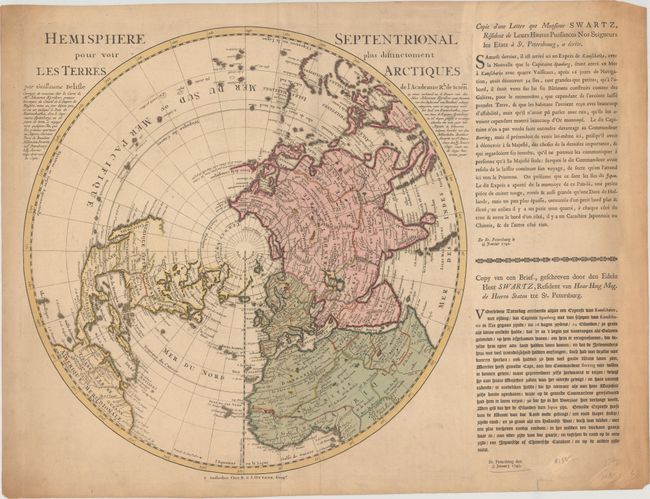
Subject: North Pole

Period: 1740 (dated)

Publication:

Color: Hand Color

Size:
17.8 x 17.8 inches
45.2 x 45.2 cm
Download High Resolution Image
(or just click on image to launch the Zoom viewer)

This important map of the Northern Hemisphere was originally issued by Delisle in 1714 and updated by the Ottens brothers. The map was drawn with Delisle’s characteristic scientific approach. It was the first map to correctly place the west coast of North America, moving it substantially east from previous mapping. California is shown as a peninsula at a time when it was often still shown as an island, even in other maps drawn by Delisle. Near the northern coast of Asia is Terre de la Compagnie with a note about its discovery by Jean de Gama. Delisle based his depiction of the Northern Pacific on the voyage of Fondant in 1709. The Ottens edition includes updates to northern Asia. A panel of text (French and German) has been added at right describing recent explorations in Kamchatka.

References: cf. Wagner #504

Condition: B+

In full original color on a watermarked sheet with light toning and soiling that is mostly concentrated in the margins outside the map image. A short fold separation along the edge of the sheet at bottom right has been closed on verso with a small piece of cello tape.

Estimate: $350 - $425

Sold for: $325

Closed on 2/6/2019

Archived