Catalog Archive
Auction 171, Lot 389

"Plan de Quito Capitale de la Province de Meme Nom dans le Royaume de Perou...",

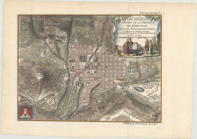
Subject: Quito, Ecuador

Period: 1741 (circa)

Publication: Journal du Voyage Fait par Ordre du Roi, a l'Equateur...

Color: Hand Color

Size:
10.3 x 7.8 inches
26.2 x 19.8 cm
Download High Resolution Image
(or just click on image to launch the Zoom viewer)

This lovely town plan of Quito, Ecuador identifies significant churches, parishes, monastic establishments, and government and municipal buildings with a lettered and numbered key at right and left. El Panecillo, a hill of volcanic origin and the location of a temple which the Indians used to worship the sun, is located at far left. The hill is now the site of the city's iconic Madonna of Quito monument. The title cartouche features Peruvians, cactus, and pineapples. This map was created by Jean-Louis Morainville and published in Charles-Marie de la Condamine's Journal du Voyage Fait par Ordre du Roi, a l'Equateur Servant d'Introduction Historique a la Mesure des Trois Premiers Degrés du Méridien, the first scientific account of the Amazon River. La Condamine was a French explorer and geographer who was sent with several other scientists to Peru in 1735 to measure the length of a degree latitude at the equator. La Condamine's research helped prove Isaac Newton's theory that the Earth was not a perfect sphere.

References:

Condition: A+

A sharp impression on a clean, bright sheet with minor marginal soiling.

Estimate: $160 - $190

Sold for: $140

Closed on 2/6/2019

Archived