Catalog Archive
Auction 171, Lot 363

"Carte de St. Domingue...", Poirson, Jean Baptiste
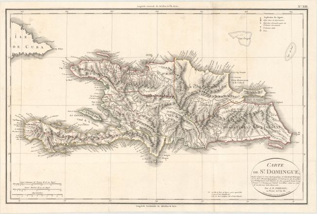
Subject: Hispaniola

Period: 1803 (dated)

Publication: Statistique Generale et Particuliere De La France et De Ses Colonies

Color: Hand Color

Size:
20 x 12.9 inches
50.8 x 32.8 cm
Download High Resolution Image
(or just click on image to launch the Zoom viewer)

This lovely map of Saint Domingue is divided into 5 regions and identifies the capital of each region. The map is filled with detail on towns, roads, topography, watershed, and safe anchorages surrounding the island. The title cartouche identifies the sources for this map as the work of Jacque Chastenet-Puisegur, Rene Phelipeaux, and Daniel Lescallier. Engraved by Tardieu.

References:

Condition: A

A crisp impression with original outline color, issued folding on watermarked paper with minor soiling.

Estimate: $160 - $190

Sold for: $90

Closed on 2/6/2019

Archived