Catalog Archive
Auction 171, Lot 228

"[Lot of 2] Chart of Santa Monica Bay California [and] Chart of San Pedro Bay", U.S. Corps of Engineers

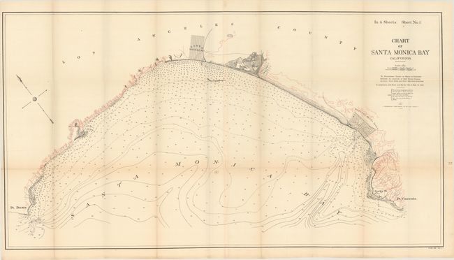
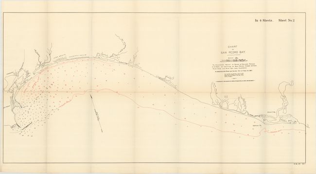
Subject: Los Angeles, California

Period: 1891 (dated)

Publication: H.R. Doc. #39, 52nd Congress, 1st Session

Color: Printed Color

Size:
See Description
Download High Resolution Image
(or just click on image to launch the Zoom viewer)

A. Chart of Santa Monica Bay California (42.6 x 23.0"). This chart extends from Pt. Dume to Pt. Vicente and shows the street plan for Santa Monica, Ballona Tract (just south of Marina del Rey) and the Redondo Beach Tract. Red overprinting indicates elevation and numerous soundings fill the bay. Joined on two sheets.

B. Chart of San Pedro Bay (33.0 x 16.4"). Covers the coastline from San Pedro to Newport Bay, noting the rivers Santa Ana, San Gabriel and New San Gabriel. Shows street patterns for Wilmington, San Pedro, Long Beach, and Alamitos Beach. Red overprinting shows numerous soundings and the 1, 2, 3 and 10 fathom depth curves.

References:

Condition: B+

Issued folding on clean, bright sheets with several short splits at fold intersections.

Estimate: $200 - $230

Sold for: $425

Closed on 2/6/2019

Archived