Catalog Archive
Auction 171, Lot 157

"Carte pour Servir a l'Historie de la Guerre Entre les Etats-Unis d'Amerique et l'Angleterre, Pendant les Annees 1812, 13, 14 et 15 [with] Histoire de la Guerre Entre les Etats-Unis d'Amerique et l'Angleterre",

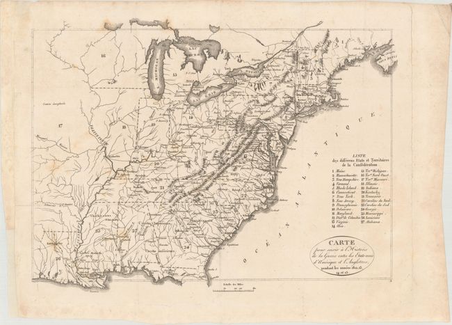
Subject: Eastern United States

Period: 1820 (published)

Publication:

Color: Black & White

Size:
13.1 x 9.8 inches
33.3 x 24.9 cm
Download High Resolution Image
(or just click on image to launch the Zoom viewer)

This map served as the frontispiece to the French edition of Henry Brackenridge's History of the Late War, between the United States and Great-Britain. The map covers the region from the Eastern seaboard to well past the Mississippi River and beyond Louisiana. 27 states and territories are keyed to the map including the large Northwest and Missouri territories where the land is noted as contree unexploree (unexplored country). East of the Mississippi, the transportation network is the focal point where wagon roads, trails and the river systems are prominently depicted.

The map is accompanied by the two volumes of French text entitled Histoire de la Guerre Entre les Etats-Unis d'Amerique et l'Angleterre. 310 pages (part 1), 317 pages (part 2), bound together. Octavo, rebound in red cloth with gilt title on spine.

References: Phillips p. 877; Howes #B-684; Sabin #7164.

Condition: B+

Issued folding with faint scattered foxing. Professionally conserved to repair a short fold separation at left and a long separation along the platemark at right (outside of the image). Text is very good with occasional foxing. New binding has light wear.

Estimate: $200 - $230

Unsold

Closed on 2/6/2019

Archived