Catalog Archive
Auction 170, Lot 616
"Ierusalem", Stoopendaal, Bastiaan
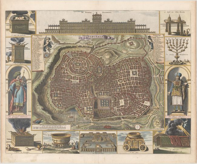
Subject: Jerusalem, Holy Land
Period: 1686 (published)
Publication:
Color: Hand Color
Size:
18.2 x 14.3 inches
46.2 x 36.3 cm
Download High Resolution Image
(or just click on image to launch the Zoom viewer)
(or just click on image to launch the Zoom viewer)