Catalog Archive
Auction 170, Lot 600

"Carte de la Turquie, de l'Arabie et de la Perse avec Leurs Dependances Dressee sur les Observations les Plus Nouvelles & les Memoires les Plus Recens", Chatelain, Henry Abraham

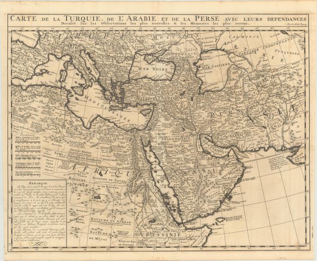
Subject: Mediterranean, Middle East & Northern Africa

Period: 1719 (circa)

Publication: Atlas Historique

Color: Black & White

Size:
20.4 x 15.9 inches
51.8 x 40.4 cm
Download High Resolution Image
(or just click on image to launch the Zoom viewer)

This striking map covering the Ottoman Empire is based on Delisle's map of the region. It spans the entirety of the Mediterranean, Africa from Algeria to Ethiopia, and the Middle East. There are numerous place names and fine topographical detail throughout. Caravan routes from Mecca to Medina are delineated. At bottom left there are five distance scales and a descriptive note on Turkey, Arabia, and Persia.

References: Ankary, p. 287; Tibbetts #221.

Condition: B+

A dark impression on a watermarked sheet with some light offsetting.

Estimate: $200 - $230

Sold for: $150

Closed on 11/14/2018

Archived