Catalog Archive
Auction 170, Lot 48

"Orbis Terrarum Veteribus Cogniti Typus Geographicus", Jansson, Jan

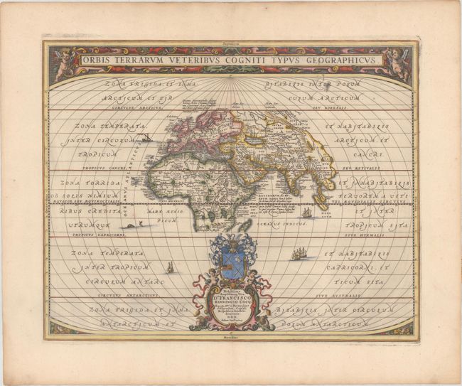
Subject: Ancient World

Period: 1741 (published)

Publication: Description Exacte de l'Univers, ou l'Ancienne Geographie Sacree et Profane

Color: Hand Color

Size:
19.8 x 15.8 inches
50.3 x 40.1 cm
Download High Resolution Image
(or just click on image to launch the Zoom viewer)

A classic map of the ancient world based on Ortelius. Europe, Asia, and Africa as far south as Madagascar are centered in a wide oval frame. The climatic zones are marked, and ships and sea creatures surround the map. The title is enclosed in a strapwork panel at top, and an elaborate cartouche at the bottom includes the dedication and beautiful coat of arms. This is the uncommon second state in which the lower dedication cartouche was beautifully completed with a crest, wind-heads, and cherubs. Blank verso, published in Pieter de Hondt's Description Exacte de l'Univers, ou l'Ancienne Geographie Sacree et Profane, a French edition of Georgius Hornius' Accuratissima Orbis Antiqui Delineatio, which included maps from Johannes Jansson's historical atlas and Abraham Ortelius' Parergon.

References: Shirley #385; Van der Krogt (Vol. 1) #0800H:1.2.

Condition: A

A sharp impression on a clean sheet with wide margins and minor toning along the edges of the sheet.

Estimate: $600 - $750

Sold for: $350

Closed on 11/14/2018

Archived