Catalog Archive
Auction 170, Lot 40

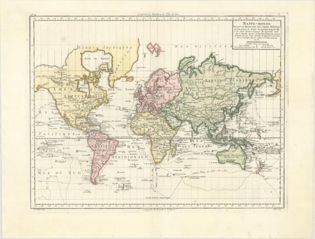
"Mappe-Monde Suivant la Projection des Cartes Reduites, ou l'on a Trace les Routes du Capitaine Bougainville et les Deux Derniers Voyages du Capitaine Cook...", Chanlaire & Mentelle

Subject: World

Period: 1798 (dated)

Publication: Atlas Universel de Geographie Physique et Politique

Color: Hand Color

Size:
16.7 x 12.8 inches
42.4 x 32.5 cm
Download High Resolution Image
(or just click on image to launch the Zoom viewer)

This handsome world map was drawn on Mercator's Projection. It features the explorations of Bougainville and Cook with the routes delineated and dated. The northern regions of Canada and Greenland are left open-ended, with Greenland connected to the mainland. Antarctica is virtually empty with only a few glaciers noted and Sandwick and Port de Drak identified. In the South Pacific, New Zealand is well defined, but Tasmania is still connected to Australia. Engraved by Pierre Francois Tardieu and Andre. This is the third state, issued by Pierre Gregoire Chanlaire with no Sea of the West in northwestern North America.

References: McGuirk #185.

Condition: A

A crisp impression with faint offsetting at bottom right.

Estimate: $190 - $220

Sold for: $95

Closed on 11/14/2018

Archived